Soldiers and Sailors Sports Ground, Erewash
Map
Facts and practical information
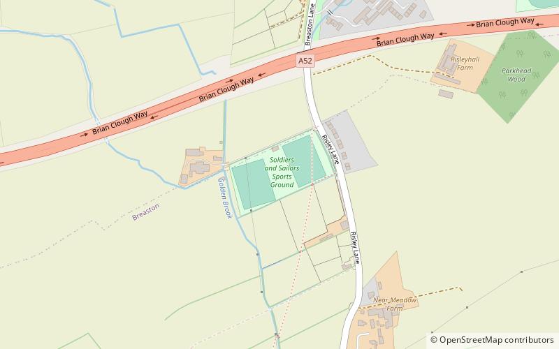
The Soldiers & Sailors Sports Ground is a sports facility, located on the outskirts of the Civil Parish of Breaston, on Risley Lane, near the A52. ()
Coordinates: 52°54'41"N, 1°19'15"W
Address
Erewash
ContactAdd
Social media
Add
Getting there by public transportation
Public transportation stops near this location
- Bus
 Bus
Bus
- Calculate routeThe Risley Park 10 min walk
- Calculate routeRisley Hall 10 min walk
- Calculate routeTreetops 12 min walk
- Calculate routePastures Farm 12 min walk
Day trips


Frequently Asked Questions (FAQ)
How to get to Soldiers and Sailors Sports Ground by public transport?
The nearest stations to Soldiers and Sailors Sports Ground:
Bus
Bus
- The Risley Park • Lines: i4 (10 min walk)
- Risley Hall • Lines: i4 (10 min walk)