Southgate Street, Gloucester
Map
Facts and practical information
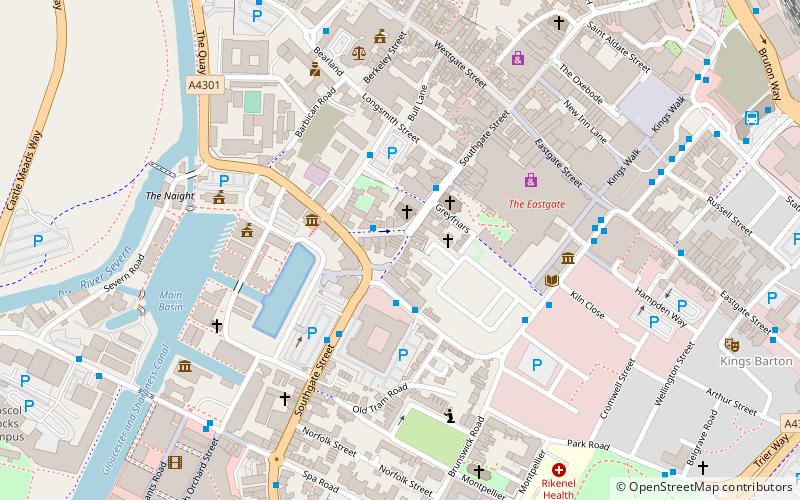
Southgate Street is one of the ancient streets in the City of Gloucester, so named because its southern end was originally the location of the south gate in the city's walls. The part beyond the gate as far as Severn Street was sometimes known as Lower Southgate Street. It runs from the crossroads of Northgate, Eastgate, Southgate, and Westgate Streets in the north to Bristol Road in the south. ()
Coordinates: 51°51'48"N, 2°14'53"W
Address
Gloucester
ContactAdd
Social media
Add
Getting there by public transportation
Public transportation stops near this location
- Train
 Train
Train
- Calculate routeGloucester 12 min walk
Day trips
Southgate Street – popular in the area (distance from the attraction)
Nearby attractions include: Eastgate Shopping Centre, Kings Walk Shopping Centre, Kingsholm Stadium, Gloucester Quays Outlet.


Frequently Asked Questions (FAQ)
Which popular attractions are close to Southgate Street?
Nearby attractions include St Kyneburgh's Chapel, Gloucester (1 min walk), Blackfriars, Gloucester (2 min walk), St Mary de Crypt Church, Gloucester (2 min walk), Marylone, Gloucester (2 min walk).
How to get to Southgate Street by public transport?
The nearest stations to Southgate Street:
Train
Train
- Gloucester (12 min walk)