Portsmouth Point, Portsmouth
Map
Facts and practical information
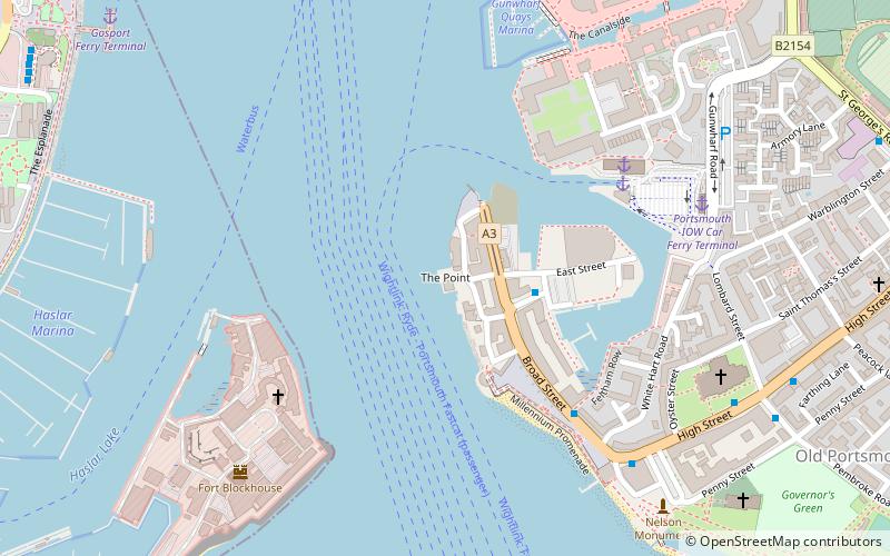
Portsmouth Point, or "Spice Island", is part of Old Portsmouth in Portsmouth, Hampshire, on the southern coast of England. The name Spice Island comes from the area's seedy reputation, as it was known as the "Spice of Life". Men were easily found and press-ganged into Nelson's navy from Portsmouth Point due to its hostelries and for being where prostitutes plied their trade. The area forms the eastern side of the narrow entrance to Portsmouth Harbour, facing Gosport on the western side. ()
Coordinates: 50°47'30"N, 1°6'35"W
Address
St. ThomasPortsmouth
ContactAdd
Social media
Add
Getting there by public transportation
Public transportation stops near this location
- Bus
- Train
- Ferry
 Bus
Bus
- Calculate routePortsmouth Car Ferry terminal 5 min walk
- Calculate routeGosport Ferry Terminal 10 min walk
- Calculate routePortsmouth Harbour 9 min walk
- Calculate routePortsmouth and Southsea 24 min walk
- Calculate routeGosport Bus Station 10 min walk
- Calculate routeThe Hard Interchange 11 min walk
Day trips
Portsmouth Point – popular in the area (distance from the attraction)
Nearby attractions include: Spinnaker Tower, Clarence Pier, HMS Victory, Gunwharf Quays.


Frequently Asked Questions (FAQ)
Which popular attractions are close to Portsmouth Point?
Nearby attractions include Round Tower, Portsmouth (3 min walk), Aspex, Portsmouth (6 min walk), Square Tower, Portsmouth (6 min walk), Fort Blockhouse, Portsmouth (6 min walk).
How to get to Portsmouth Point by public transport?
The nearest stations to Portsmouth Point:
Ferry
Train
Bus
Ferry
- Portsmouth Car Ferry terminal • Lines: Portsmouth - Fishbourne (vehicle ferry) (5 min walk)
- Gosport Ferry Terminal • Lines: Gosport-Portsmouth Hard (10 min walk)
Train
- Portsmouth Harbour (9 min walk)
- Portsmouth and Southsea (24 min walk)
Bus
- Gosport Bus Station (10 min walk)
- The Hard Interchange (11 min walk)