The Corona, Canterbury
Map

Map

Facts and practical information
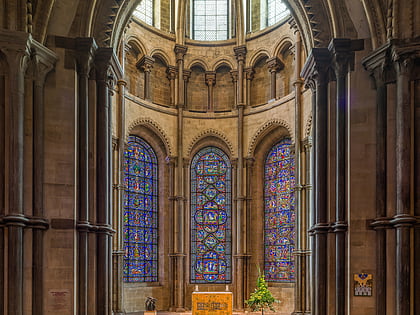
The Corona, Canterbury Cathedral is the east end of Canterbury Cathedral, named after the severed crown of Thomas Becket, whose shrine it was built to contain. ()
Coordinates: 51°16'47"N, 1°4'59"E
Address
Canterbury
ContactAdd
Social media
Add
Day trips
The Corona – popular in the area (distance from the attraction)
Nearby attractions include: Canterbury Cathedral, St Augustine's Abbey, St Martin's Church, Canterbury Roman Museum.
Frequently Asked Questions (FAQ)
Which popular attractions are close to The Corona?
Nearby attractions include Chair of St Augustine, Canterbury (1 min walk), Trinity Chapel, Canterbury (1 min walk), St Thomas of Canterbury Church, Canterbury (3 min walk), Canterbury Roman Museum, Canterbury (3 min walk).
How to get to The Corona by public transport?
The nearest stations to The Corona:
Bus
Train
Bus
- Whitefriars • Lines: El450, P2 (6 min walk)
- Canterbury Bus Station (7 min walk)
Train
- Canterbury West (12 min walk)
- Canterbury East (13 min walk)


