Lamb and Flag, London

Gallery (1)
Map
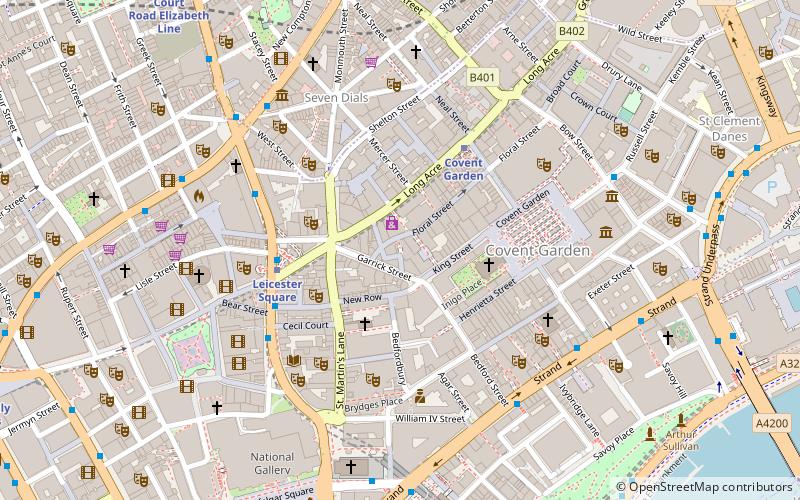
Map
Facts and practical information
The Lamb and Flag is a Grade II listed public house at Rose Street, Covent Garden, London, WC2. ()
Coordinates: 51°30'42"N, 0°7'32"W
Address
33 Rose St, WC2E 9EBCity of Westminster (St. James's)London
Contact
+44 20 7497 9504
Social media
Add
Getting there by public transportation
Public transportation stops near this location
- Metro
- Bus
- Train
- Ferry
 Metro
Metro
- Calculate routeLeicester Square 3 min walk
- Calculate routeCovent Garden 3 min walk
- Calculate routeCharing Cross 7 min walk
- Calculate routeEmbankment 9 min walk
- Calculate routeCambridge Circus 5 min walk
- Calculate routeBedford Street 5 min walk
- Calculate routeSouthampton Street / Covent Garden 5 min walk
- Calculate routeGerrard Place / Chinatown 6 min walk
- Calculate routeCharing Cross 8 min walk
- Calculate routeLondon Waterloo 22 min walk
- Calculate routeWaterloo East 24 min walk
- Calculate routeLondon Blackfriars 25 min walk
- Calculate routeEmbankment 10 min walk
- Calculate routeFestival Pier 12 min walk
- Calculate routeLondon Eye - Waterloo Pier 16 min walk
- Calculate routeWestminster Pier 18 min walk
Maps Tube
Tube
TubeDay trips


Frequently Asked Questions (FAQ)
Which popular attractions are close to Lamb and Flag?
Nearby attractions include Floral Street, London (1 min walk), St Paul's, London (3 min walk), Arts Theatre, London (3 min walk), Noel Coward Theatre, London (3 min walk).
How to get to Lamb and Flag by public transport?
The nearest stations to Lamb and Flag:
Metro
Bus
Train
Ferry
Metro
- Leicester Square • Lines: Northern, Piccadilly (3 min walk)
- Covent Garden • Lines: Piccadilly (3 min walk)
Bus
- Cambridge Circus • Lines: 38, N38 (5 min walk)
- Bedford Street • Lines: N26 (5 min walk)
Train
- Charing Cross (8 min walk)
- London Waterloo (22 min walk)
Ferry
- Embankment • Lines: Green Tour, Rb1, Rb1X, Rb2, Rb6 (10 min walk)
- Festival Pier • Lines: Green Tour (12 min walk)