Trafford Waters, Manchester
Map
Facts and practical information
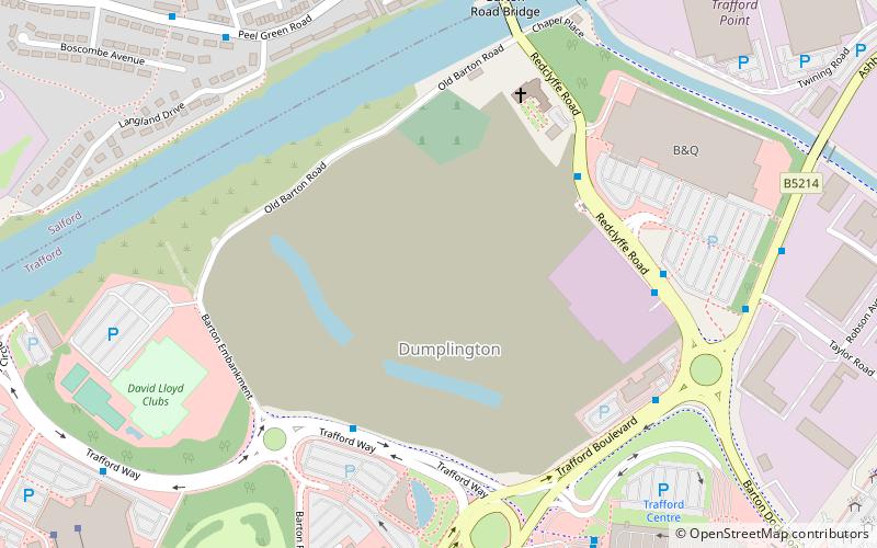
Trafford Waters is a major mixed-use proposed development in Trafford, Greater Manchester on land between the Manchester Ship Canal and the Trafford Centre. The land is owned and will be developed by the Peel Group. The development is proposed to take place in six phases over 15 years, with the first phase being completed by 2017–18. The area would be served by the proposed Trafford Quays Metrolink station. ()
Coordinates: 53°28'17"N, 2°21'17"W
Address
Trafford (Davyhulme East)Manchester
ContactAdd
Social media
Add
Getting there by public transportation
Public transportation stops near this location
- Bus
- Tram
- Train
 Bus
Bus
- Calculate routeThe Trafford Centre Bus Station 7 min walk
- Calculate routeTrafford Centre Bus Station STAND 11 7 min walk
- Calculate routeTrafford Centre Bus Station STAND 12 8 min walk
- Calculate routeThe Trafford Centre, Trafford Boulevard / opposite Old Park Lane 8 min walk
- Calculate routeThe Trafford Centre 10 min walk
- Calculate routeBarton Dock Road 17 min walk
- Calculate routeEccles 30 min walk
- Calculate routeLadywell 37 min walk
- Calculate routePatricroft 24 min walk
- Calculate routeEccles 34 min walk
Maps MetrolinkMaps
 Metrolink / Rail
MetrolinkMapsMetrolink / RailDay trips


Frequently Asked Questions (FAQ)
Which popular attractions are close to Trafford Waters?
Nearby attractions include All Saints' Church, Manchester (4 min walk), Barton Road Swing Bridge, Manchester (6 min walk), Barton Swing Aqueduct, Manchester (7 min walk), Chill Factore, Sale (10 min walk).
How to get to Trafford Waters by public transport?
The nearest stations to Trafford Waters:
Bus
Tram
Train
Bus
- The Trafford Centre Bus Station (7 min walk)
- Trafford Centre Bus Station STAND 11 • Lines: 23 (7 min walk)
Tram
- The Trafford Centre • Lines: Corn, TrfC (10 min walk)
- Barton Dock Road • Lines: Corn, TrfC (17 min walk)
Train
- Patricroft (24 min walk)
- Eccles (34 min walk)