Derby Built-up Area, Derby
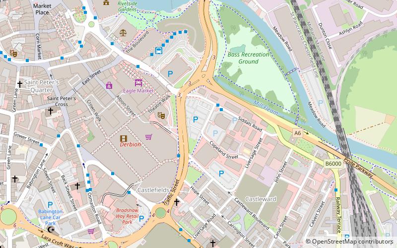
Map
Facts and practical information
Derby is a city and unitary authority area in Derbyshire, England. It lies on the banks of the River Derwent in the south of Derbyshire, of which it was traditionally the county town. Derby gained city status in 1977, and by the 2011 census its population was 248,700. ()
Getting there by public transportation
Public transportation stops near this location
- Bus
- Train
 Bus
Bus
- Calculate routeSiddals Road 2 min walk
- Calculate routeIntu Centre 2 min walk
- Calculate routeDerby Bus Station 5 min walk
- Calculate routeDerby 11 min walk
Day trips
Derby Built-up Area – popular in the area (distance from the attraction)
Nearby attractions include: Derbion, Derby Museum and Art Gallery, Derby Cathedral, St Mary's Bridge Chapel.


Frequently Asked Questions (FAQ)
Which popular attractions are close to Derby Built-up Area?
Nearby attractions include Bounce Revolution - Family Activity Centre, Derby (2 min walk), Derby Theatre, Derby (2 min walk), Congregational Chapel, Derby (5 min walk), Holy Trinity Church, Derby (6 min walk).
How to get to Derby Built-up Area by public transport?
The nearest stations to Derby Built-up Area:
Bus
Train
Bus
- Siddals Road • Lines: 1, 1A, Unibus6 (2 min walk)
- Intu Centre • Lines: 2A, 2B (2 min walk)
Train
- Derby (11 min walk)