The End, London
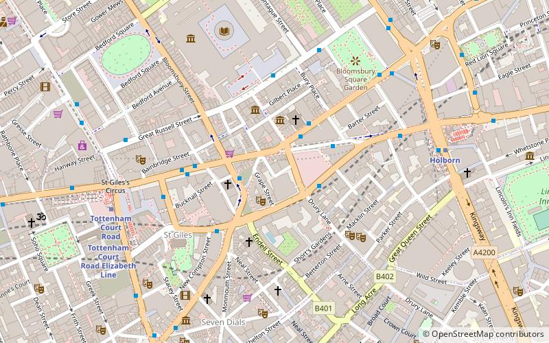
Map
Facts and practical information
The End was a nightclub in the West End of London, England. Started in December 1995 by DJs Layo Paskin and Mr C, it was also responsible for the label End Recordings. ()
Coordinates: 51°31'0"N, 0°7'31"W
Getting there by public transportation
Public transportation stops near this location
- Metro
- Bus
- Train
- Ferry
 Metro
Metro
- Calculate routeDrury Lane 2 min walk
- Calculate routeMuseum Street 2 min walk
- Calculate routeNew Oxford Street 2 min walk
- Calculate routeSt Giles High Street 3 min walk
- Calculate routeTottenham Court Road 6 min walk
- Calculate routeHolborn 7 min walk
- Calculate routeCovent Garden 7 min walk
- Calculate routeLeicester Square 10 min walk
- Calculate routeCharing Cross 17 min walk
- Calculate routeLondon Euston 24 min walk
- Calculate routeCity Thameslink 25 min walk
- Calculate routeLondon Blackfriars 27 min walk
- Calculate routeEmbankment 18 min walk
- Calculate routeFestival Pier 19 min walk
- Calculate routeLondon Eye - Waterloo Pier 24 min walk
- Calculate routeWestminster Pier 27 min walk
Maps Tube
Tube
TubeDay trips


Frequently Asked Questions (FAQ)
Which popular attractions are close to The End?
Nearby attractions include Shaftesbury Theatre, London (2 min walk), The Cartoon Museum, London (2 min walk), St George's, London (2 min walk), Abbott and Holder, London (3 min walk).
How to get to The End by public transport?
The nearest stations to The End:
Bus
Metro
Train
Ferry
Bus
- Drury Lane • Lines: N242 (2 min walk)
- Museum Street • Lines: 38, 55, N242, N38, N55 (2 min walk)
Metro
- Tottenham Court Road • Lines: Central, Northern (6 min walk)
- Holborn • Lines: Central, Piccadilly (7 min walk)
Train
- Charing Cross (17 min walk)
- London Euston (24 min walk)
Ferry
- Embankment • Lines: Green Tour, Rb1, Rb1X, Rb2, Rb6 (18 min walk)
- Festival Pier • Lines: Green Tour (19 min walk)