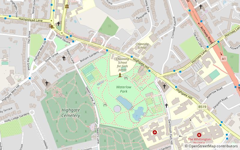
Waterlow Park, London
Map
Facts and practical information
Waterlow Park is a 26-acre park in the south east of Highgate Village, in north London. It was given to the public by Sir Sydney Waterlow, as "a garden for the gardenless" in 1889. ()
Elevation: 371 ft a.s.l.Coordinates: 51°34'9"N, 0°8'42"W
Address
Swain's Ln N6Camden (Highgate)London
Contact
+44 20 7974 8810
Social media
Add
Getting there by public transportation
Public transportation stops near this location
- Metro
- Bus
- Train
 Metro
Metro
- Calculate routeCromwell Avenue 5 min walk
- Calculate routeSouth Grove 5 min walk
- Calculate routeSt Michael's Church 8 min walk
- Calculate routeArchway 14 min walk
- Calculate routeHighgate 16 min walk
- Calculate routeTufnell Park 23 min walk
- Calculate routeUpper Holloway 20 min walk
- Calculate routeGospel Oak 26 min walk
- Calculate routeHampstead Heath 34 min walk
Maps Tube
Tube
TubeDay trips


Frequently Asked Questions (FAQ)
Which popular attractions are close to Waterlow Park?
Nearby attractions include Highgate, London (5 min walk), Highgate Cemetery, London (5 min walk), Tomb of Karl Marx, London (7 min walk), Upstairs at The Gatehouse, London (7 min walk).
How to get to Waterlow Park by public transport?
The nearest stations to Waterlow Park:
Bus
Metro
Train
Bus
- Cromwell Avenue • Lines: W5 (5 min walk)
- South Grove • Lines: 271 (5 min walk)
Metro
- Archway • Lines: Northern (14 min walk)
- Highgate • Lines: Northern (16 min walk)
Train
- Upper Holloway (20 min walk)
- Gospel Oak (26 min walk)