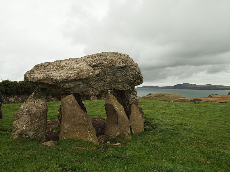
Carreg Samson, Abercastle

Gallery (2)
Map
Map
Gallery
Facts and practical information
Carreg Samson is a 5000-year-old Neolithic dolmen located half a mile west of Abercastle near the Pembrokeshire Coast Path in Wales. ()
Coordinates: 51°57'47"N, 5°7'12"W
Address
Abercastle
ContactAdd
Social media
Add
Day trips


