Trempealeau Mountain, Trempealeau

Gallery (5)
Map

Map

Gallery
Facts and practical information
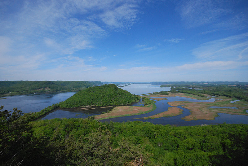
Trempealeau Mountain State Natural Area is a Wisconsin Department of Natural Resources-designated State Natural Area consisting of a 425-foot conical rock mound surrounded on three sides by the Mississippi and Trempealeau Rivers. It is one of only 3 solid rock islands along the entire Mississippi River. ()
Established: 2002 (24 years ago)Elevation: 922 ft a.s.l.Coordinates: 44°1'17"N, 91°29'47"W
Day trips


