Burnside Bridge, Portland
Map

Gallery

Facts and practical information
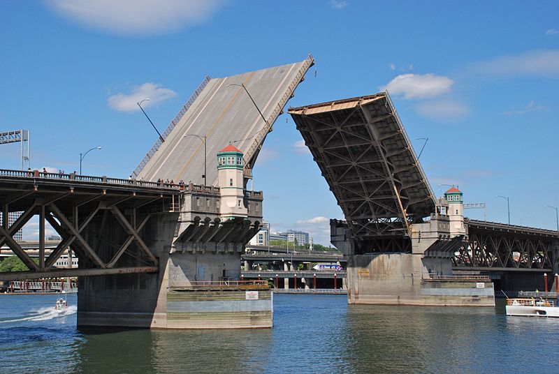
The Burnside Bridge is a 1926-built bascule bridge that spans the Willamette River in Portland, Oregon, United States, carrying Burnside Street. It is the second bridge at the same site to carry that name. It was added to the National Register of Historic Places in November 2012. ()
Length: 1382 ftWidth: 74 ftCoordinates: 45°31'23"N, 122°39'58"W
Address
E Burnside St.Hawthorne District (Buckman)Portland 97204
ContactAdd
Social media
Add
Day trips
Burnside Bridge – popular in the area (distance from the attraction)
Nearby attractions include: Dante's, CC Slaughters, Barbarella, Silverado.
Frequently Asked Questions (FAQ)
Which popular attractions are close to Burnside Bridge?
Nearby attractions include Kevin Duckworth Memorial Dock, Portland (4 min walk), Yard, Portland (4 min walk), Ira F. Powers Warehouse and Factory, Portland (5 min walk), Portland Saturday Market, Portland (5 min walk).
How to get to Burnside Bridge by public transport?
The nearest stations to Burnside Bridge:
Tram
Bus
Light rail
Train
Tram
- Northeast Martin Luther King & East Burnside • Lines: A (6 min walk)
- Southeast Grand & East Burnside • Lines: B (7 min walk)
Bus
- Northwest Naito Parkway & Couch • Lines: 16 (6 min walk)
- Southeast Martin Luther King & Ash • Lines: 6 (6 min walk)
Light rail
- Skidmore Fountain • Lines: Blue, Red (7 min walk)
- Old Town/Chinatown • Lines: Blue, Red (8 min walk)
Train
- Portland Union Station (18 min walk)


