Island Park, Racine
Map
Facts and practical information
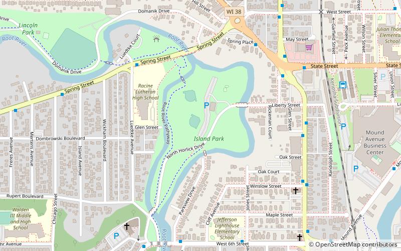
Island Park or Horlick Park is a neighborhood park covering 19 acres of land in Racine, Wisconsin. The park is located on an island, surrounded on both sides by the Root River. The land for the park was donated by William Horlick, the inventor of malted milk. ()
Elevation: 591 ft a.s.l.Coordinates: 42°43'47"N, 87°48'13"W
Address
300 Horlick DrIsland ParkRacine 53405
ContactAdd
Social media
Add
Getting there by public transportation
Public transportation stops near this location
- Bus
 Bus
Bus
- Calculate routeSpring Street And Luedtke Avenue 5 min walk
- Calculate routeN Memorialdriveand Stande Street 6 min walk
- Calculate routeStande Street & Spring Street 6 min walk
Day trips


Frequently Asked Questions (FAQ)
Which popular attractions are close to Island Park?
Nearby attractions include 5Th Street Yacht Club, Racine (16 min walk), George Bray Neighborhood Center, Racine (23 min walk).
How to get to Island Park by public transport?
The nearest stations to Island Park:
Bus
Bus
- Spring Street And Luedtke Avenue • Lines: 86 (5 min walk)
- N Memorialdriveand Stande Street • Lines: 2 (6 min walk)