Burns Commons, Milwaukee
Map

Gallery

Facts and practical information
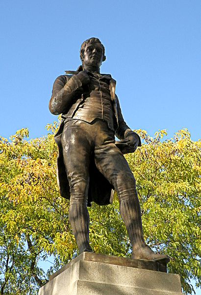
Burns Commons is a park in the Milwaukee County Parks system. It is located on the East Side of the city, bound by Franklin Pl. Prospect Ave. and Ogden Ave. It is split into two sections by Knapp Street. The larger, northern section is landscaped with trees, lawn and walkways, and includes public art. The smaller southern portion holds a statue of Scottish poet Robert Burns. ()
Created: 1847Elevation: 656 ft a.s.l.Coordinates: 43°2'48"N, 87°53'48"W
Address
1300 N FRANKLIN PlDowntown Milwaukee (Yankee Hill)Milwaukee
ContactAdd
Social media
Add
Day trips
Burns Commons – popular in the area (distance from the attraction)
Nearby attractions include: Milwaukee Art Museum, Betty Brinn Children's Museum, St. Hedwig's, Green Gallery.
Frequently Asked Questions (FAQ)
Which popular attractions are close to Burns Commons?
Nearby attractions include Jewish Museum Milwaukee, Milwaukee (4 min walk), Shank Hall, Milwaukee (4 min walk), Immanuel Presbyterian Church, Milwaukee (5 min walk), St. Paul's Episcopal Church, Milwaukee (6 min walk).
How to get to Burns Commons by public transport?
The nearest stations to Burns Commons:
Tram
Bus
Train
Tram
- Burns Commons • Lines: M (3 min walk)
- Ogden at Astor • Lines: M (5 min walk)
Bus
- FlixBus Milwaukee • Lines: 2511 (31 min walk)
- Milwaukee Greyhound Station (35 min walk)
Train
- Milwaukee (34 min walk)


