Alta, Salt Lake City
#124 among attractions in Salt Lake City


Facts and practical information
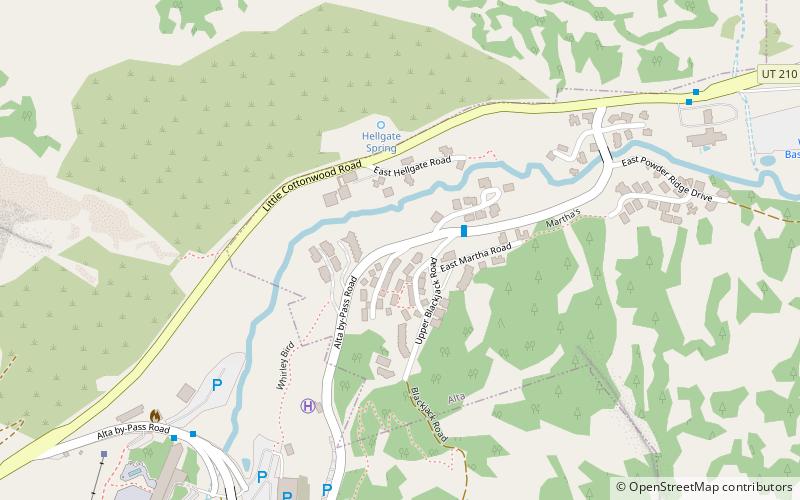
Alta is a town in eastern Salt Lake County, Utah, United States. It is part of the Salt Lake City, Utah Metropolitan Statistical Area. The population was 383 at the 2010 census, a slight increase from the 2000 figure of 370. ()
Salt Lake City plan & book
Unleash the traveler in you — discover the cheapest flight deals, find the perfect hotel or hostel nearby, and search for the best car rental prices. Travel at your own pace to discover new places and enjoy your journey.
Alta – popular in the area (distance from the attraction)
Nearby attractions include: Brighton Ski Resort, Cecret Lake, Little Cottonwood Canyon, Doughnut Falls.
3.6 miEVernacular architecture, Sport venue, SportBrighton Ski Resort, Salt Lake City
92 min walk • Tucked away in the majestic Wasatch Mountains, Brighton Ski Resort is a premier destination for skiers and snowboarders in Salt Lake City, United States. Known for its impressive snowfall and diverse terrain, Brighton offers a sporty retreat for winter sports...
1.8 miSENatural attraction, Hiking trail, ParkCecret Lake, Salt Lake City
46 min walk • Cecret Lake is a small alpine lake in Albion Basin which is within the town limits of Alta in the U.S. state of Utah. This area is also part of the Wasatch National Forest. Cecret Lake is also a protected watershed for Salt Lake City.
3.2 miWNature, Natural attraction, CanyonLittle Cottonwood Canyon, Salt Lake City
83 min walk • Little Cottonwood Canyon lies within the Wasatch-Cache National Forest along the eastern side of the Salt Lake Valley, roughly 15 miles from Salt Lake City, Utah. The canyon is part of Granite, a CDP and "Community Council" designated by Salt Lake County.
3 miNNatural attraction, WaterfallDoughnut Falls, Salt Lake City
77 min walk • Doughnut Falls is a waterfall in the Big Cottonwood Canyon near Silver Fork, south of Midvale in Salt Lake County, Utah. Access to Chocolate Falls is from the Mill D Trailhead towards the Jordan Pines picnic area.
4.7 miSWNatural attraction, Mountain, Vernacular architecturePfeifferhorn, Lone Peak Wilderness
120 min walk • The Pfeifferhorn is the 11,331 feet triangularly-shaped peak located in the most isolated part of the Lone Peak Wilderness Area of the Wasatch Mountains in northern Utah, United States.
5.4 miNHiking trail, Hiking, HotelHistoric Union Pacific Rail Trail State Park, Salt Lake City
139 min walk • The Historic Union Pacific Rail Trail State Park is a recreational trail that follows abandoned railroad lines in Summit County, Utah, United States. The Historic Union Pacific Rail Trail is 28 miles long, and averages 125 feet wide.
4.3 miNWNature, Natural attraction, Vernacular architectureBig Cottonwood Canyon, Salt Lake City
110 min walk • Big Cottonwood Canyon is a canyon in the Wasatch Range 12 miles southeast of Salt Lake City in the U.S. state of Utah. The 15-mile-long canyon provides hiking, biking, picnicking, rock-climbing, camping and fishing in the summer.
3.4 miENature, Natural attraction, LakeDog Lake, Salt Lake City
87 min walk • Dog Lake is a lake in Salt Lake County, Utah located near the Brighton Ski Resort.
5.6 miNNature, Natural attraction, LakeDog Lake, Salt Lake City
143 min walk • Dog Lake is a lake in Salt Lake County, Utah located between Millcreek Canyon and Big Cottonwood Canyon. The lake can be accessed by hiking trails from either canyon.
3.9 miWNature, MountainTwin Peaks, Salt Lake City
100 min walk • Twin Peaks is an American television series, running from 1990 to 1991; and in 2017. Twin Peaks may also refer...
5.6 miNWVernacular architectureStairs Station Hydroelectric Power Plant Historic District, Salt Lake City
144 min walk • The Stairs Station Hydroelectric Power Plant was built in 1894-1895 in Big Cottonwood Canyon, about 8 miles southeast of Salt Lake City, Utah. The plant comprises the powerhouse, switchyard, penstocks, and a pipeline.