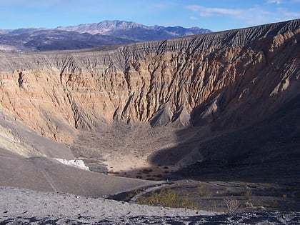
Ubehebe Craters, Death Valley National Park
Map

Map

Facts and practical information
Ubehebe Craters is a volcanic field in California. In northern Death Valley, it consists of 14-16 craters in a 3-square-kilometre area. The largest of these craters is the 800 metres wide and 235 metres deep Ubehebe Crater, but many of these craters are partially buried and thus poorly recognizable. Additional volcanic features present include a remnant of a scoria cone as well as a tuff cone. ()
Last eruption: 150 B.C.E.Elevation: 2467 ftCoordinates: 37°0'36"N, 117°26'60"W
Address
Death Valley National Park
ContactAdd
Social media
Add
Day trips
Ubehebe Craters – popular in the area (distance from the attraction)
Nearby attractions include: Ubehebe Crater.

