Kearsarge Pass, Devils Postpile National Monument
#3 among attractions in Devils Postpile National Monument
![Kearsarge Pass location map](https://tzmedia.b-cdn.net/media/images/static-maps/us/36_7726_-118_376.jpg)
Facts and practical information
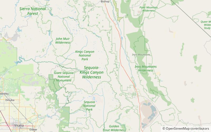
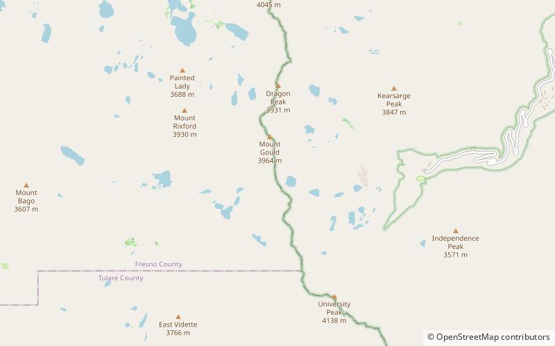
Kearsarge Pass is a pass in the Sierra Nevada of California. The pass lies on the Sierra Crest at 11,709 feet. The pass permits foot traffic between Kings Canyon National Park and the John Muir Wilderness. ()
Devils Postpile National Monument United States
Devils Postpile National Monument plan & book
Unleash the traveler in you — discover the cheapest flight deals, find the perfect hotel or hostel nearby, and search for the best car rental prices. Travel at your own pace to discover new places and enjoy your journey.
Kearsarge Pass – popular in the area (distance from the attraction)
Nearby attractions include: Mount Bago, Mount Rixford, East Vidette, Rae Lakes.
3.4 miWMountainMount Bago, Kings Canyon National Park
88 min walk • Mount Bago is an 11,870-foot-elevation mountain summit located west of the crest of the Sierra Nevada mountain range, in the southeast corner of Fresno County, in northern California.
1.5 miNWMountainMount Rixford, Kings Canyon National Park
39 min walk • Mount Rixford is a 12,887-foot-elevation mountain summit located one mile west of the crest of the Sierra Nevada mountain range, in the southeast corner of Fresno County, in northern California. It is situated in Kings Canyon National Park, 11.5 miles west of the community ...
2.4 miSWMountainEast Vidette, Kings Canyon National Park
62 min walk • East Vidette is a 12,356-foot-elevation mountain summit located two miles west of the crest of the Sierra Nevada mountain range, in the northeast corner of Tulare County in northern California. It is situated in Kings Canyon National Park, 12.5 miles west-southwest of the...
2.8 miNWNature, Natural attraction, LakeRae Lakes, Kings Canyon National Park
73 min walk • Rae Lakes is a series of lakes in the Sierra Nevada, located in Kings Canyon National Park, eastern Fresno County, California. The lakes are located on the John Muir Trail at the base of Black Mountain.
3.5 miNWMountainFin Dome, Kings Canyon National Park
89 min walk • Fin Dome is an 11,673-foot-elevation granite summit located 1.5 mile west of the crest of the Sierra Nevada mountain range, in the southeast corner of Fresno County, in northern California. It is situated in the Rae Lakes area of Kings Canyon National Park, approximately 15.5 miles west of the community of Independence.
3.6 miSWMountainWest Vidette, Kings Canyon National Park
92 min walk • West Vidette is a 12,533-foot-elevation mountain summit located three miles west of the crest of the Sierra Nevada mountain range, in the northeast corner of Tulare County in northern California. It is situated in Kings Canyon National Park, 13.5 miles west-southwest of the community of Independence, and 1.27 miles west of East Vidette.
3.6 miSMountainCenter Peak, Kings Canyon National Park
92 min walk • Center Peak is a 12,760-foot-elevation mountain summit located one mile west of the crest of the Sierra Nevada mountain range, in the northeast corner of Tulare County in northern California.
0.5 miNNature, Natural attraction, MountainMount Gould, Kings Canyon National Park
13 min walk • Mount Gould is a thirteener on the Sierra crest, just north of the Kearsarge Pass.
4.9 miSNature, Natural attraction, MountainMount Stanford, Kings Canyon National Park
125 min walk • Mount Stanford, at an elevation of 13,979 feet, is on the Kings-Kern Divide in Kings Canyon National Park. It is named for Stanford University.
1.2 miSWMountainKearsarge Pinnacles, Kings Canyon National Park
31 min walk • Kearsarge Pinnacles is a linear series of 12 pillars and crags on a northwest–southeast trending ridge located one mile west of the crest of the Sierra Nevada mountain range, in the southeast corner of Fresno County, in northern California.
3.8 miNNature, Natural attraction, MountainDiamond Peak, Kings Canyon National Park
97 min walk • Diamond Peak is a 13,133-foot mountain in the Sierra Nevada on the boundary between Fresno and Inyo Counties, California in the United States. It is on the Sierra Crest. The west side of Diamond Peak is located in Kings Canyon National Park, at the headwater of Woods Creek, and the east side is located in the Inyo National Forest.