Alamo Plaza Historic District, San Antonio
Map
Map

Facts and practical information
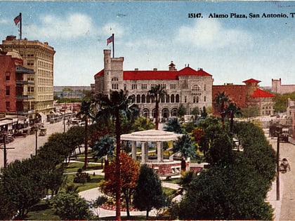
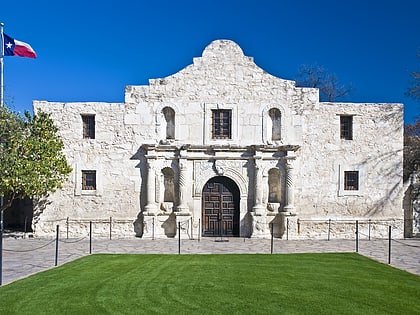
The Alamo Plaza Historic District is an historic district of downtown San Antonio in the U.S. state of Texas. It was listed on the National Register of Historic Places in 1977. It includes the Alamo, which is a separately listed Registered Historic Place and a U.S. National Historic Landmark. ()
Built: 1836 (190 years ago)Coordinates: 29°25'31"N, 98°29'8"W
Address
Central City (Downtown San Antonio)San Antonio
ContactAdd
Social media
Add
Day trips
Alamo Plaza Historic District – popular in the area (distance from the attraction)
Nearby attractions include: The Alamo, Tower of the Americas, Shops at Rivercenter, Buckhorn Saloon and Museum.
Frequently Asked Questions (FAQ)
Which popular attractions are close to Alamo Plaza Historic District?
Nearby attractions include The Alamo, San Antonio (2 min walk), Alamo Cenotaph, San Antonio (3 min walk), Ripley's Haunted Adventure San Antonio, San Antonio (3 min walk), St. Joseph Catholic Church, San Antonio (4 min walk).
How to get to Alamo Plaza Historic District by public transport?
The nearest stations to Alamo Plaza Historic District:
Bus
Train
Bus
- San Antonio Greyhound Station (11 min walk)
- Robert Thompson Transit Station (16 min walk)
Train
- San Antonio (16 min walk)
