Muir Pass, Kings Canyon National Park
#71 among attractions in Kings Canyon National Park


Facts and practical information
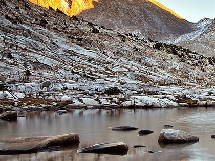
Muir Pass is a mountain pass in the Sierra Nevada of California, United States, in Kings Canyon National Park. It is named for John Muir. ()
Kings Canyon National Park United States
Muir Pass – popular in the area (distance from the attraction)
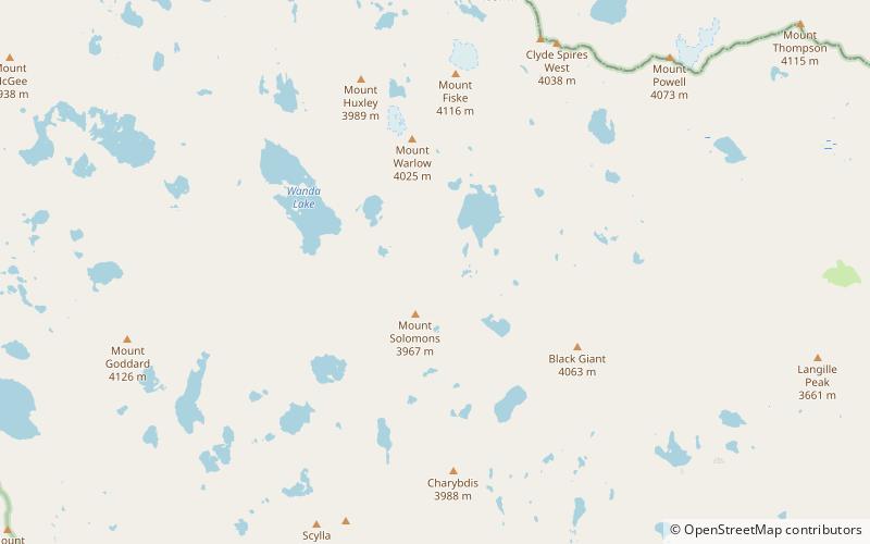
Nearby attractions include: The Hermit, Black Giant, Mount Fiske, Mount Warlow.
 Mountain
The Hermit, John Muir Wilderness
113 min walk • The Hermit is a 12,328-foot-elevation mountain summit located west of the crest of the Sierra Nevada mountain range, in Fresno County of northern California, United States. It is situated in northern Kings Canyon National Park, 2.5 miles east of Emerald Peak, and 2.5 miles west of Mount Darwin.
 Mountain
Black Giant
36 min walk • Black Giant is a 13,330-foot-elevation mountain summit located near the crest of the Sierra Nevada mountain range, in Fresno County of northern California, United States. Black Giant ranks as the 86th highest summit in California.
 Mountain
Mount Fiske, John Muir Wilderness
45 min walk • Mount Fiske is a 13,503-foot-elevation mountain summit located near the crest of the Sierra Nevada mountain range, in Fresno County of northern California, United States. It is situated in northern Kings Canyon National Park, 23 miles west of the community of Big Pine, 0.83...
 Mountain
Mount Warlow, John Muir Wilderness
31 min walk • Mount Warlow is a 13,206-foot-elevation mountain summit located 1.5 miles west of the crest of the Sierra Nevada mountain range, in Fresno County of northern California, United States. It is situated on the Goddard Divide in northern Kings Canyon National Park, 1.2 miles north...
 Mountain
Langille Peak
87 min walk • Langille Peak is a 12,018-foot-elevation mountain summit located near the crest of the Sierra Nevada mountain range, in Fresno County of northern California, United States.
 Mountain
Mount McGee, John Muir Wilderness
106 min walk • Mount McGee is a 12,944-foot-elevation mountain summit located west of the crest of the Sierra Nevada mountain range, in Fresno County of northern California, United States. It is situated in Kings Canyon National Park, 0.6 miles southeast of Peter Peak, 2 miles southwest of The...
 Mountain
Mount McDuffie
78 min walk • Mount McDuffie is a 13,291-foot-elevation mountain summit located west of the crest of the Sierra Nevada mountain range, in Fresno County of northern California, United States. This peak is situated in Kings Canyon National Park, 1.9 miles northwest of The Citadel, and two miles south of Black Giant, which is the nearest higher neighbor.
 Mountain
Peter Peak, John Muir Wilderness
121 min walk • Peter Peak is a 12,490-foot-elevation mountain summit located west of the crest of the Sierra Nevada mountain range, in Fresno County of northern California, United States. It is situated in Kings Canyon National Park, 2 miles southwest of The Hermit, and 0.6 mile northwest of Mount McGee, the nearest higher neighbor.
 Nature, Natural attraction, Mountain
Mount Spencer, Kings Canyon National Park
77 min walk • Mount Spencer is a 12,431 feet peak in the Sierra Nevada, in Kings Canyon National Park and Fresno County, California.
 Nature, Natural attraction, Mountain
Mount Darwin, John Muir Wilderness
98 min walk • Mount Darwin is a flat-topped mountain in the Sierra Nevada, on the border of between Fresno and Inyo counties in Kings Canyon National Park and the John Muir Wilderness of California.
 Nature, Natural attraction, Mountain
Mount Mendel, Kings Canyon National Park
113 min walk • Mount Mendel is a peak in Fresno County, California. It is in Kings Canyon National Park in the Evolution Region, of the Sierra Nevada and adjacent to Mount Darwin which is on the Sierra crest.
