Shell Falls, Bighorn National Forest

Gallery (3)
Map
Map
Gallery
Facts and practical information
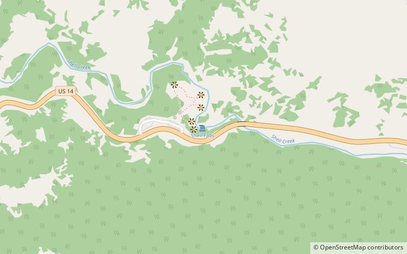
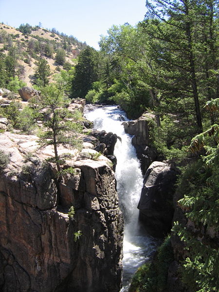
Shell Falls is a waterfall in the Bighorn National Forest on Shell Creek, about halfway down Shell Canyon, and a few miles upstream from the town of Shell in northeast Wyoming. The falls are 120 feet in height and tumble over basement rock of granite. ()
Elevation: 6234 ft a.s.l.Coordinates: 44°35'11"N, 107°36'50"W
Address
U.S. 14, Bighorn National ForestBighorn National Forest
ContactAdd
Social media
Add
Day trips
Shell Falls – popular in the area (distance from the attraction)
Nearby attractions include: Granite Pass.