War Mothers Memorial Bridge, Frankfort
Map
Facts and practical information
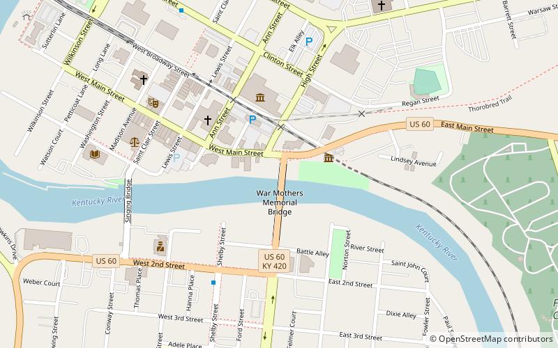
The War Mothers Memorial Bridge is a box girder bridge that carries US 60 and KY 420 across the Kentucky River in Frankfort, Kentucky. The bridge carries approximately 12,900 cars per day as of 2009. The bridge was built in 1938. At some point, US 60 was shifted from the Singing Bridge just downstream to the War Mothers Memorial Bridge. This bridge connects Frankfort to the Kentucky State Capitol. ()
Opened: 1938 (88 years ago)Length: 705 ftWidth: 45 ftCoordinates: 38°11'50"N, 84°52'27"W
Address
Frankfort
ContactAdd
Social media
Add
Day trips


Frequently Asked Questions (FAQ)
Which popular attractions are close to War Mothers Memorial Bridge?
Nearby attractions include Capital City Museum, Frankfort (4 min walk), Kentucky Historical Society, Frankfort (4 min walk), Old Governor's Mansion, Frankfort (4 min walk), Old State Capitol, Frankfort (7 min walk).