Palouse Falls

Gallery (4)
Map

Map
Gallery
Facts and practical information
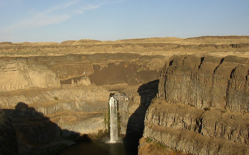
Palouse Falls is a waterfall on the Palouse River, about 4 mi upstream of the confluence with the Snake River in southeast Washington, United States. The falls are 200 ft in height. The falls consist of an upper fall with a drop around 20 ft, which lies 1,000 ft north-northwest of the main drop, and a lower fall, with a drop of 200 ft. It is in the 94-acre Palouse Falls State Park. ()
Location
Washington
ContactAdd
Social media
Add
Day trips
Palouse Falls – popular in the area (distance from the attraction)
Nearby attractions include: Palouse Falls.
