Stevens Center, Winston-Salem
Map
Facts and practical information
The Roger L. Stevens Center is the primary performance venue in downtown Winston-Salem, North Carolina and is owned and operated by the University of North Carolina School of the Arts. It is named after the theatre producer and real estate magnate Roger L. Stevens and was opened on April 22, 1983. The venue serves the major UNCSA productions, the Winston-Salem Symphony, Piedmont Opera, and many other touring and local productions. All in all the theatre is used for rehearsal or performance all but 70 days of the year. ()
Coordinates: 36°5'55"N, 80°14'54"W
Address
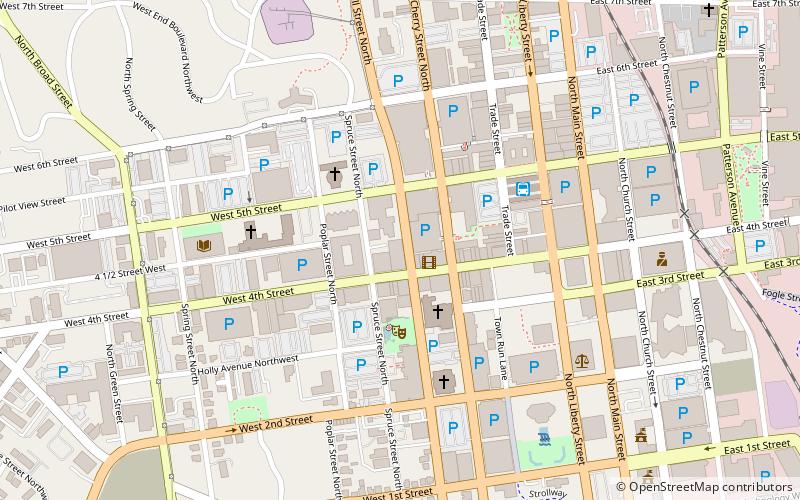
405 W 4th StDowntown Winston-SalemWinston-Salem 27101-2804
Contact
+1 336-721-1945
Social media
Add
Getting there by public transportation
Public transportation stops near this location
- Bus
 Bus
Bus
- Calculate routeWinston Salem Bus Terminal 5 min walk
Day trips
Stevens Center – popular in the area (distance from the attraction)
Nearby attractions include: Truist Stadium, Sosnik-Morris-Early Commercial Block, Winston-Salem City Hall, Downtown North Historic District.


Frequently Asked Questions (FAQ)
Which popular attractions are close to Stevens Center?
Nearby attractions include Fourth and Trade, Winston-Salem (4 min walk), Sawtooth School for Visual Art, Winston-Salem (5 min walk), Forsyth County Courthouse, Winston-Salem (6 min walk), Delurk Gallery, Winston-Salem (6 min walk).
How to get to Stevens Center by public transport?
The nearest stations to Stevens Center:
Bus
Bus
- Winston Salem Bus Terminal (5 min walk)