Topeka Boulevard Bridge, Topeka
Map
Facts and practical information
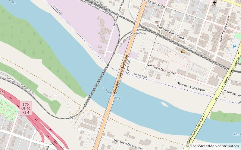
The Topeka Boulevard Bridge is a four-lane automobile and pedestrian crossing of the Kansas River at Topeka, Kansas, U.S.A. A complete rebuilding of the bridge took place from 2006 to 2008, in which guarded walkways for pedestrians were added, as well as various aesthetic amenities, like a clock. The bridge spans the Kansas River from West 1st Avenue to NW Gordon Street. ()
Coordinates: 39°3'54"N, 95°40'26"W
Address
North Topeka EastTopeka
ContactAdd
Social media
Add
Getting there by public transportation
Public transportation stops near this location
- Bus
- Train
 Bus
Bus
- Calculate routeTopeka 27 min walk
- Calculate route3rd & Branner 30 min walk
- Calculate route6th & Branner 34 min walk
Day trips


Frequently Asked Questions (FAQ)
Which popular attractions are close to Topeka Boulevard Bridge?
Nearby attractions include Great Overland Station, Topeka (7 min walk), North Kansas Avenue Bridge, Topeka (11 min walk), North Topeka Baptist Church, Topeka (12 min walk), Ward-Meade Park Botanical Gardens, Topeka (12 min walk).
How to get to Topeka Boulevard Bridge by public transport?
The nearest stations to Topeka Boulevard Bridge:
Train
Bus
Train
- Topeka (27 min walk)
Bus
- 3rd & Branner • Lines: 2 (30 min walk)
- 6th & Branner • Lines: 1 (34 min walk)