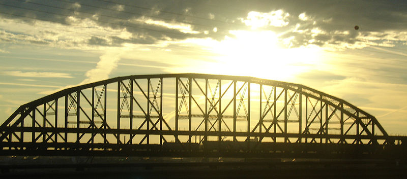
MacArthur Bridge, St. Louis

Gallery (3)
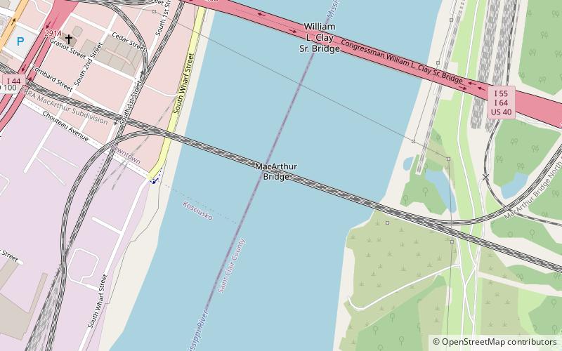
Map
Map
Gallery
Facts and practical information
The MacArthur Bridge is a truss bridge that connects St. Louis, Missouri and East St. Louis, Illinois over the Mississippi River. The bridge was initially called the "St. Louis Municipal Bridge" and known popularly as the "Free Bridge" due to the original lack of tolls. Tolls were added for auto traffic beginning in 1932. In 1942, the bridge was renamed for Douglas MacArthur. The bridge was constructed to break the monopoly of the Terminal Railroad Association, which controlled two other bridges at St. Louis and charged what were viewed as unreasonable tolls. ()
Opened: 1917 (109 years ago)Length: 3.46 miCoordinates: 38°36'53"N, 90°11'2"W
Address
St. Louis
ContactAdd
Social media
Add
Getting there by public transportation
Public transportation stops near this location
- Bus
- Light rail
- Train
 Bus
Bus
- Calculate routeStadium 22 min walk
- Calculate route8th & Pine 26 min walk
- Calculate routeLaclede's Landing 26 min walk
- Calculate routeEast Riverfront 28 min walk
- Calculate routeA 31 min walk
- Calculate routeC 31 min walk
- Calculate routeE 32 min walk
- Calculate routeG 32 min walk
- Calculate routeSaint Louis 32 min walk
Day trips


Frequently Asked Questions (FAQ)
Which popular attractions are close to MacArthur Bridge?
Nearby attractions include Poplar Street Bridge, St. Louis (7 min walk), St. Mary of Victories Church, St. Louis (11 min walk), Eugene Field House, St. Louis (15 min walk), Old Cathedral, St. Louis (17 min walk).
How to get to MacArthur Bridge by public transport?
The nearest stations to MacArthur Bridge:
Light rail
Bus
Train
Light rail
- Stadium • Lines: Blue, Red (22 min walk)
- 8th & Pine • Lines: Blue, Red (26 min walk)
Bus
- A • Lines: 30 (31 min walk)
- C • Lines: 40 (31 min walk)
Train
- Saint Louis (32 min walk)