Fort Trumbull, New London
Map

Gallery

Facts and practical information
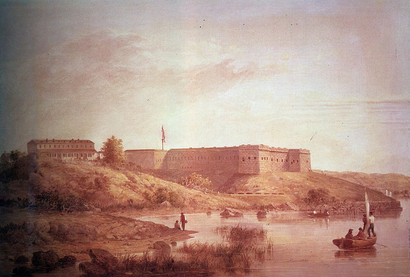
Fort Trumbull is a fort near the mouth of the Thames River on Long Island Sound in New London, Connecticut and named for Governor Jonathan Trumbull. The original fort was built in 1777, but the present fortification was built between 1839 and 1852. The site lies adjacent to the Coast Guard Station New London and is managed as the 16-acre Fort Trumbull State Park by the Connecticut Department of Energy and Environmental Protection. ()
Elevation: 23 ft a.s.l.Coordinates: 41°20'37"N, 72°5'35"W
Day trips
Fort Trumbull – popular in the area (distance from the attraction)
Nearby attractions include: St. James Episcopal Church, Shaw's Cove Bridge, Custom House Maritime Museum, Fort Griswold Battlefield State Park.
Frequently Asked Questions (FAQ)
Which popular attractions are close to Fort Trumbull?
Nearby attractions include Shaw's Cove Bridge, New London (11 min walk), Shaw Mansion, New London (16 min walk), Custom House Maritime Museum, New London (16 min walk), Ohev Sholem Synagogue, New London (16 min walk).
How to get to Fort Trumbull by public transport?
The nearest stations to Fort Trumbull:
Train
Bus
Ferry
Train
- New London (19 min walk)
Bus
- Greyhound Bus Station (20 min walk)
Ferry
- Cross Sound Ferry (22 min walk)


