Penn State Ice Pavilion, State College
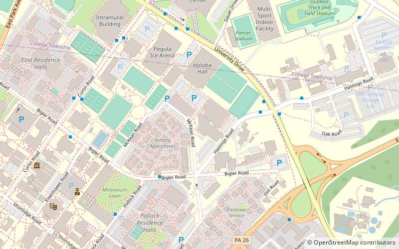
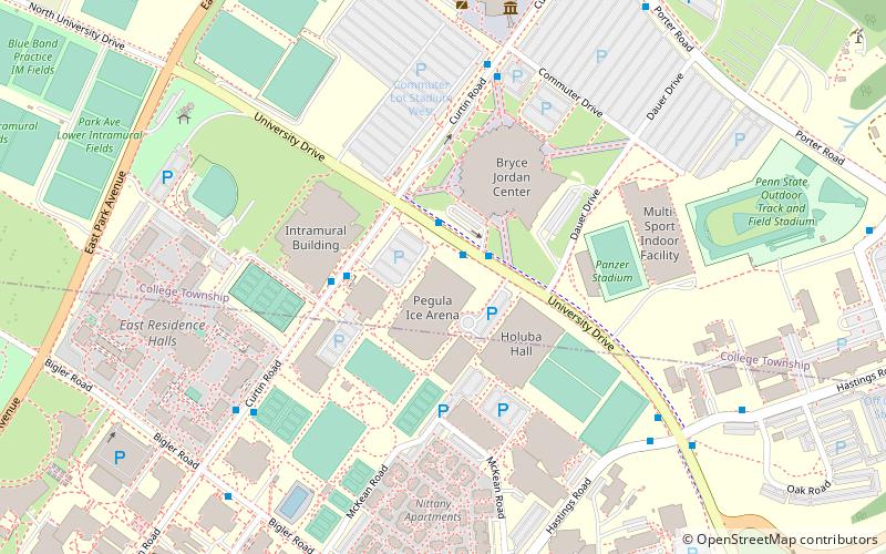
Map
Facts and practical information
The Penn State Ice Pavilion was a 1,350-seat ice arena on the campus of The Pennsylvania State University located in University Park, Pennsylvania, United States. The ice arena included an NHL regulation sized 200' x 85' ice sheet as well as a 45' x 55' studio ice sheet. ()
Opened: 1980 (46 years ago)Capacity: 1350Coordinates: 40°48'15"N, 77°51'19"W
Getting there by public transportation
Public transportation stops near this location
- Bus
 Bus
Bus
- Calculate routeHastings Road at University Drive 4 min walk
- Calculate routeBigler Road at Nittany Community Center 4 min walk
- Calculate routeUniversity Drive at Hastings Road 4 min walk
- Calculate routeUniversity Drive at Lot 83 West 5 min walk
Day trips


Frequently Asked Questions (FAQ)
Which popular attractions are close to Penn State Ice Pavilion?
Nearby attractions include Pegula Ice Arena, State College (6 min walk), Bryce Jordan Center, State College (8 min walk), Frost Entomological Museum, State College (10 min walk), Eisenhower Auditorium, State College (10 min walk).
How to get to Penn State Ice Pavilion by public transport?
The nearest stations to Penn State Ice Pavilion:
Bus
Bus
- Hastings Road at University Drive • Lines: Bl (4 min walk)
- Bigler Road at Nittany Community Center • Lines: Bl (4 min walk)