Upper Newport Bay State Marine Conservation Area, Newport Beach
Map
Facts and practical information
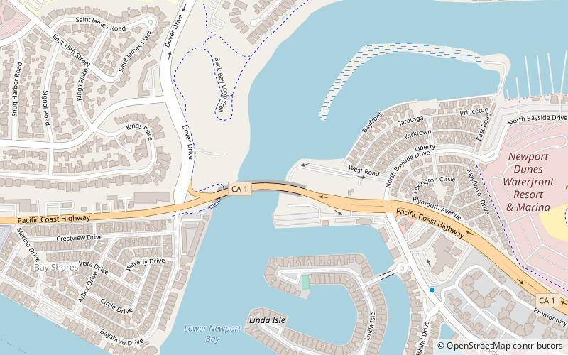
Upper Newport Bay State Marine Conservation Area is a marine protected area in Newport Bay in Orange County and the South Coast region of Southern California. It extends inland/northeast from the Pacific Coast Highway crossing of the bay, within the city of Newport Beach. ()
Coordinates: 33°37'1"N, 117°54'14"W
Address
Newport Beach (Bayside)Newport Beach
ContactAdd
Social media
Add
Day trips


Frequently Asked Questions (FAQ)
Which popular attractions are close to Upper Newport Bay State Marine Conservation Area?
Nearby attractions include Newport Back Bay, Newport Beach (16 min walk), Newport Beach Sailing Charters, Newport Beach (18 min walk), Lido Isle, Newport Beach (21 min walk), Newport Aquatic Center, Newport Beach (21 min walk).