Mary's River Covered Bridge, Chester
Map

Map

Facts and practical information
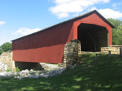
Mary's River Covered Bridge is a covered bridge which crosses Marys River 4 miles northeast of Chester, Illinois. The Burr truss bridge is 86 feet long and 17 feet 8 inches wide. The bridge was built in 1854 as part of a plank toll road connecting Chester to Bremen; the bridge allowed agricultural products to be transported to Chester, a significant port on the Mississippi River. In the early 1870s, the toll road and the bridge were sold to Randolph County. The bridge served road traffic until 1930. ()
Built: 1854 (172 years ago)Coordinates: 37°56'55"N, 89°45'57"W
Day trips
Mary's River Covered Bridge – popular in the area (distance from the attraction)
Nearby attractions include: Chester Public Library, Turkey Bluffs State Fish and Wildlife Area.


