Handy Chapel, Grand Junction

Gallery (1)
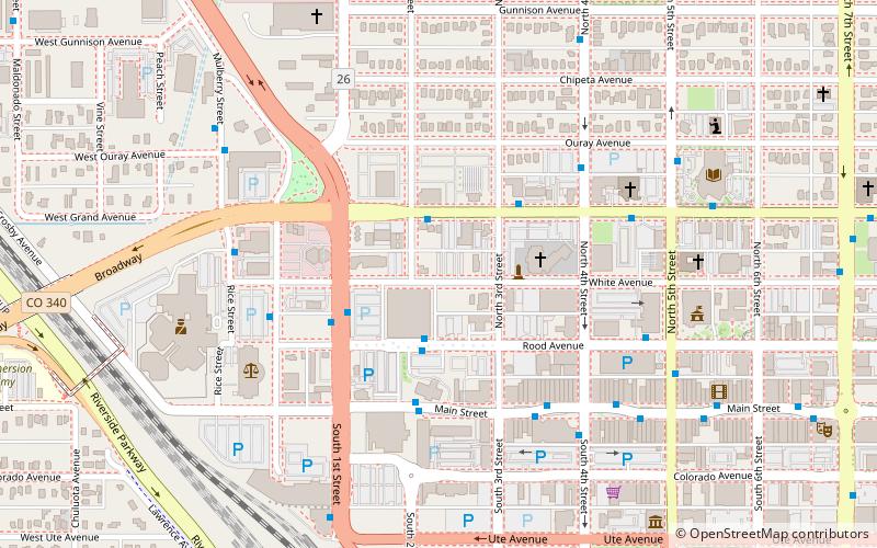
Map
Map
Facts and practical information
Handy Chapel is the only original church building still standing in the original square mile of Grand Junction, Colorado. The land that the chapel was built on was deeded to "the black citizens of Grand Junction" for the express purpose of building a place of worship in 1883, just two short years after Grand Junction was originally staked out by town founder and Governor George A. Crawford. It took the African American community nine years to raise the required $962.50 to build the church, which was completed in 1892. ()
Coordinates: 39°4'10"N, 108°34'8"W
Getting there by public transportation
Public transportation stops near this location
- Bus
- Train
 Bus
Bus
- Calculate routeGrand Avenue + East of 2nd Street 2 min walk
- Calculate routeRood Avenue + 2nd Street 2 min walk
- Calculate route1st Street + North of Rood Avenue 3 min walk
- Calculate routeGrand Junction 9 min walk
Day trips
Handy Chapel – popular in the area (distance from the attraction)
Nearby attractions include: Western Colorado Botanical Gardens, Western Colorado Center for the Arts, Mesa County Public Library District, The Palette.


Frequently Asked Questions (FAQ)
Which popular attractions are close to Handy Chapel?
Nearby attractions include The Palette, Grand Junction (7 min walk), Mesa County Public Library District, Grand Junction (8 min walk), Aspen Photo Art Gallery, Grand Junction (10 min walk), North Seventh Street Historic Residential District, Grand Junction (13 min walk).
How to get to Handy Chapel by public transport?
The nearest stations to Handy Chapel:
Bus
Train
Bus
- Grand Avenue + East of 2nd Street • Lines: 5 (2 min walk)
- Rood Avenue + 2nd Street • Lines: 11 (2 min walk)
Train
- Grand Junction (9 min walk)