Trek Zone

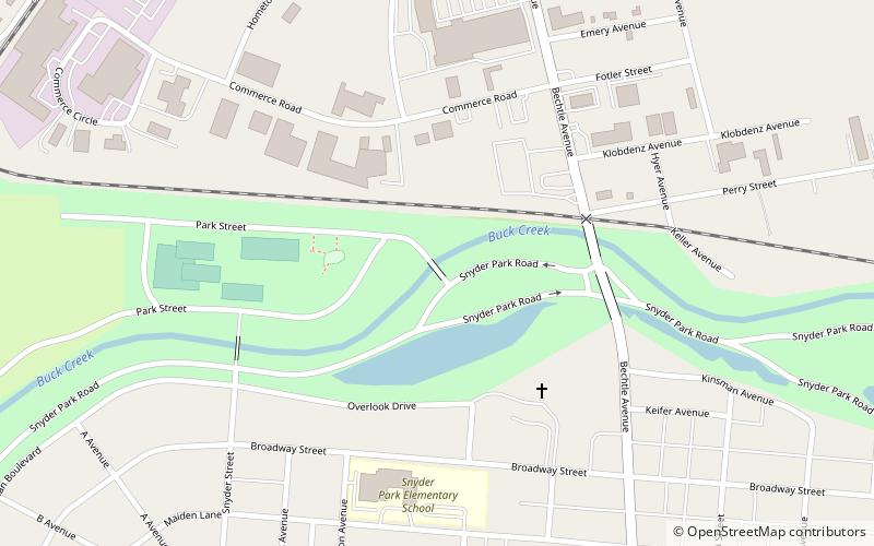
Snyder Park Road, Springfield

#16 among attractions in Springfield

Bridge
Snyder Park Road

Facts and practical information

Snyder Park Road (address: Park St) is a place located in Springfield (Ohio state) and belongs to the category of bridge.

It is situated at an altitude of 899 feet, and its geographical coordinates are 39°56'1"N latitude and 83°50'13"W longitude.

Among other places and attractions worth visiting in the area are: Frame Haven Art Gallery (museum, 15 min walk), Pennsylvania House (museum, 16 min walk), Ferncliff Cemetery & Arboretum (cemetery, 27 min walk).

Coordinates: 39°56'1"N, 83°50'13"W
Address

Park StSpringfield United States

ContactAdd
Social media
Add

Springfield plan & book

Unleash the traveler in you — discover the cheapest flight deals, find the perfect hotel or hostel nearby, and search for the best car rental prices. Travel at your own pace to discover new places and enjoy your journey.

Day trips

Snyder Park Road – popular in the area (distance from the attraction)

Nearby attractions include: Upper Valley Mall, Pennsylvania House, St. John's Evangelical Lutheran Church, Ferncliff Cemetery & Arboretum.

  • upper valley mall springfield location map
    1.4 miNW
  • pennsylvania house springfield0.6 miSE
  • st johns evangelical lutheran church springfield1.3 miSE
  • ferncliff cemetery arboretum springfield1 miNE
  • frame haven art gallery springfield0.6 miNE
  • wittenberg university springfield1.2 miE

Frequently Asked Questions (FAQ)

Which popular attractions are close to Snyder Park Road?

Nearby attractions include Frame Haven Art Gallery, Springfield (15 min walk), Pennsylvania House, Springfield (16 min walk).

Where to next? Visit ohio Ohio region page or discover the top tourist attractions in United States.