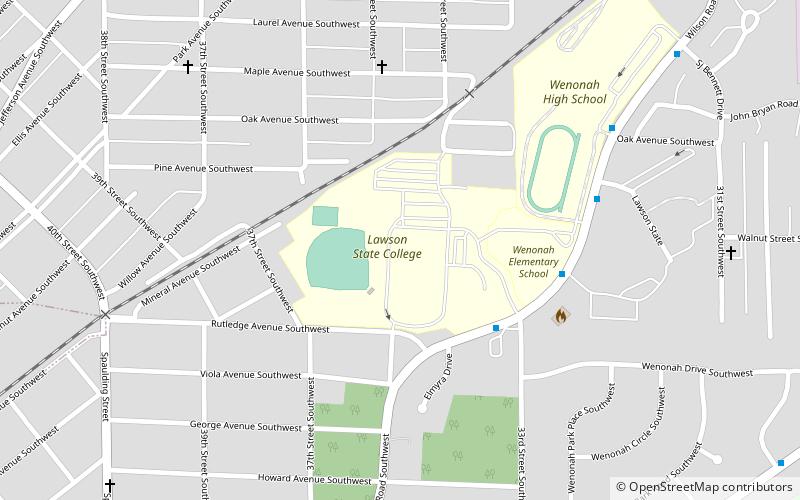
Lawson State Community College, Birmingham
Map
Facts and practical information
Lawson State Community College is a public, historically black community college with campuses in Birmingham and Bessemer, Alabama. The technical division of the college was founded as Wenonah State Technical Institute in Birmingham in 1949. Lawson State is accredited by the Southern Association of Colleges and Schools Commission on Colleges, and offers nearly 200 associate degree and certificate programs. ()
Established: 1949 (77 years ago)Coordinates: 33°27'4"N, 86°53'23"W
Address
3060 Wilson Rd SWGrasselli (Industrial Center)Birmingham 35221
Contact
Social media
Add
Getting there by public transportation
Public transportation stops near this location
- Bus
 Bus
Bus
- Calculate routeSW Corner of Wilson Rd SW & 33rd St SW 4 min walk
- Calculate routeW Side of Wilson Rd SW 6 min walk
- Calculate routeSE Corner of Wilson Rd SW & Lawson St 7 min walk
- Calculate routeNW Corner of Wilson Rd SW & Oak Av SW 8 min walk
Day trips


Frequently Asked Questions (FAQ)
How to get to Lawson State Community College by public transport?
The nearest stations to Lawson State Community College:
Bus
Bus
- SW Corner of Wilson Rd SW & 33rd St SW • Lines: 3 (4 min walk)
- W Side of Wilson Rd SW • Lines: 3 (6 min walk)