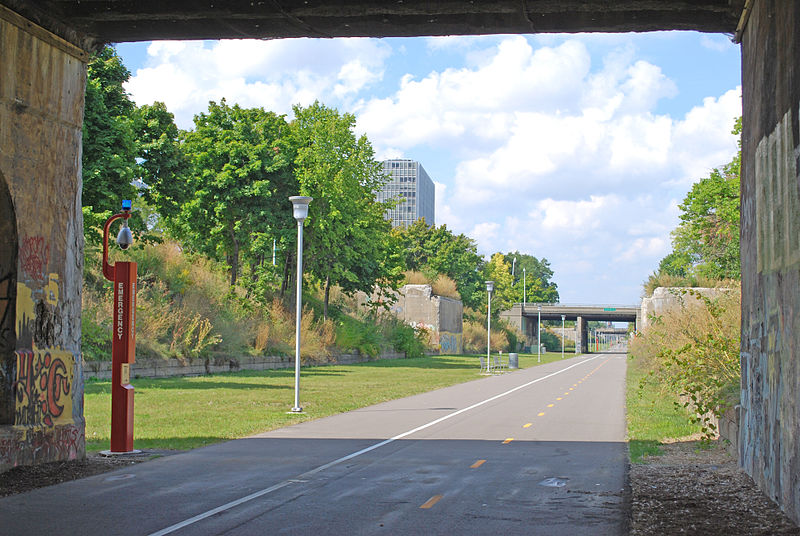
Dequindre Cut, Detroit
Map

Gallery

Facts and practical information
The Dequindre Cut is a below-grade pathway, formerly a Grand Trunk Western Railroad line, located on the east side of Detroit, Michigan, just west of St. Aubin Street. Much of the Cut has been converted to a greenway; the colorful graffiti along the pathway has been left in place. ()
Elevation: 607 ft a.s.l.Coordinates: 42°20'37"N, 83°2'0"W
Address
Lafayette ParkDetroit
ContactAdd
Social media
Add
Day trips
Dequindre Cut – popular in the area (distance from the attraction)
Nearby attractions include: Ford Field, Comerica Park, Chene Park, Greektown Casino.
Frequently Asked Questions (FAQ)
Which popular attractions are close to Dequindre Cut?
Nearby attractions include Antietam Avenue Bridge, Detroit (4 min walk), St. Joseph Oratory, Detroit (5 min walk), Lafayette Laundry, Detroit (6 min walk), St. John's–St. Luke's Evangelical Church, Detroit (6 min walk).
How to get to Dequindre Cut by public transport?
The nearest stations to Dequindre Cut:
Bus
Light rail
Tram
Bus
- Orleans / Chateaufort Pl • Lines: 52 (1 min walk)
- St Aubin / Thornhill Pl NS • Lines: 52 (3 min walk)
Light rail
- Greektown • Lines: Dpm (20 min walk)
- Bricktown • Lines: Dpm (21 min walk)
Tram
- Grand Circus Park • Lines: QLine (26 min walk)
- Montcalm Street • Lines: QLine (26 min walk)


