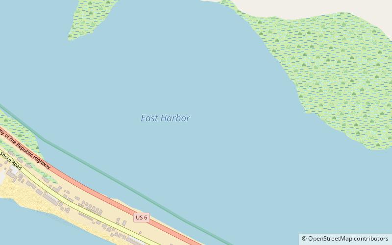
East Harbor, Cape Cod National Seashore
Map
Facts and practical information
East Harbor is a tidal estuary in Truro, Massachusetts that was originally a harbor until it was cut off from Cape Cod Bay to form a salt marsh lagoon, later renamed Pilgrim Lake. It is now within the Cape Cod National Seashore. ()
Coordinates: 42°3'33"N, 70°7'46"W
Address
Outer Cape (Truro)Cape Cod National Seashore
ContactAdd
Social media
Add
Day trips