Trek Zone

Kansas Turnpike Bridges, Lawrence
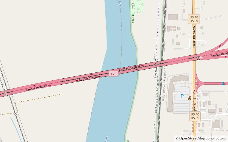
#17 among attractions in Lawrence

Bridge
Kansas Turnpike Bridges location map
Map

Facts and practical information

Opened: 1956 (68 years ago)Coordinates: 38°59'32"N, 95°14'22"W
Address

Lawrence United States

ContactAdd
Social media
Add
Day trips

Kansas Turnpike Bridges – popular in the area (distance from the attraction)

Nearby attractions include: Watkins Museum of History, St. Luke African Methodist Episcopal Church, Lawrence Public Library, Lawrence Arts Center.

  • watkins museum of history lawrence2 miS
  • st luke african methodist episcopal church lawrence1.8 miS
  • lawrence public library1.5 miS
  • lawrence arts center1.8 miS
  • douglas county courthouse lawrence2 miS
  • plymouth congregational church lawrence1.8 miS
  • massachusetts street lawrence1.8 miS
  • the granada lawrence location map
    1.9 miS
  • u s 40 and 59 bridges lawrence1.1 miS
  • lawrence blockhouses location map
    1.5 miS
  • phoenix gallery lawrence1.6 miS

Where to next? Visit kansas Kansas region page or discover the top tourist attractions in United States.