Jonestown, Baltimore
Map

Map

Facts and practical information
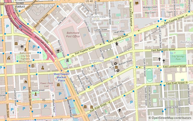
Jonestown is a neighborhood in the southeastern district of Baltimore. Its boundaries are the north side of Pratt Street, the west side of Central Avenue, the east side of Fallsway, and the south side of Orleans Street. The neighborhood lies north of the Little Italy, south of the Old Town, west of the Washington Hill, and east of the Downtown Baltimore neighborhoods. The southern terminus of the Jones Falls Expressway is located here. ()
Coordinates: 39°17'27"N, 76°36'10"W
Address
Southeastern Baltimore (Jonestown)Baltimore
ContactAdd
Social media
Add
Day trips
Jonestown – popular in the area (distance from the attraction)
Nearby attractions include: National Aquarium, War Memorial Plaza, Flag House & Star-Spangled Banner Museum, Little Italy.
Frequently Asked Questions (FAQ)
Which popular attractions are close to Jonestown?
Nearby attractions include Lloyd Street Synagogue, Baltimore (3 min walk), Jewish Museum of Maryland, Baltimore (3 min walk), McKim's School, Baltimore (3 min walk), B'nai Israel Synagogue, Baltimore (3 min walk).
How to get to Jonestown by public transport?
The nearest stations to Jonestown:
Bus
Metro
Light rail
Train
Bus
- Jewish Museum of Maryland • Lines: Orange (3 min walk)
- Albemarle Square • Lines: Br, Orange (4 min walk)
Metro
- Shot Tower/Market Place • Lines: M (5 min walk)
- Charles Center • Lines: M (16 min walk)
Light rail
- Baltimore Arena • Lines: Lr (23 min walk)
- Lexington Market • Lines: Lr (23 min walk)
Train
- Baltimore Camden Station (26 min walk)
- Baltimore Penn Station (35 min walk)


