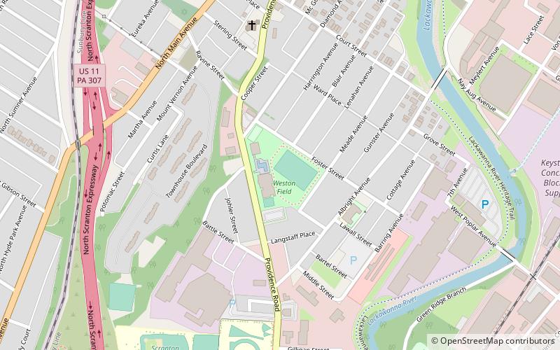
Weston Field, Scranton
Map
Facts and practical information
Weston Field is a community sports facility in Scranton, Pennsylvania, United States, built in about 1916 and named for Charles Weston. ()
Elevation: 686 ft a.s.l.Coordinates: 41°25'28"N, 75°39'55"W
Address
982 Providence RdThe PlotScranton 18508
ContactAdd
Social media
Add
Getting there by public transportation
Public transportation stops near this location
- Bus
 Bus
Bus
- Calculate routeLackawanna Transit Center & Martz Trailways Bus Terminal 27 min walk
Day trips
Weston Field – popular in the area (distance from the attraction)
Nearby attractions include: The Marketplace at Steamtown, Steamtown National Historic Site, Lackawanna Heritage Valley National and State Heritage Area, Electric City Trolley Museum.


Frequently Asked Questions (FAQ)
Which popular attractions are close to Weston Field?
Nearby attractions include Co-op Farmers Market, Scranton (6 min walk), Houdini Museum, Scranton (15 min walk), Tripp Park Community Center, Scranton (20 min walk), Scranton Armory, Scranton (23 min walk).
How to get to Weston Field by public transport?
The nearest stations to Weston Field:
Bus
Bus
- Lackawanna Transit Center & Martz Trailways Bus Terminal (27 min walk)