Mount Whitney Trail, Mount Whitney
#3 among attractions in Mount Whitney
![blank map](https://tzassets.b-cdn.net/static/img/blank-map-colors-sm.png)
![Mount Whitney Trail, Mount Whitney](https://tzmedia.b-cdn.net/media/images/us/place/gallery/medium/9facbe7a6cabe5bdb5db504b804ce045.jpg)
Facts and practical information
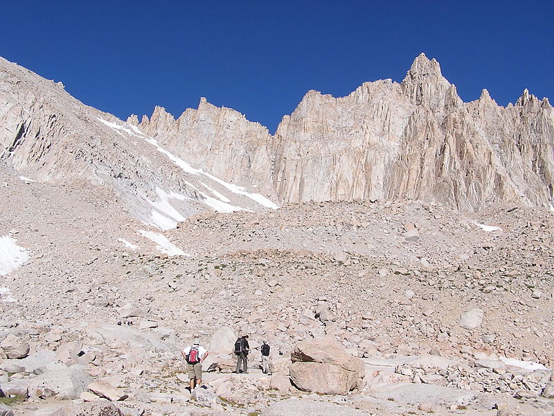
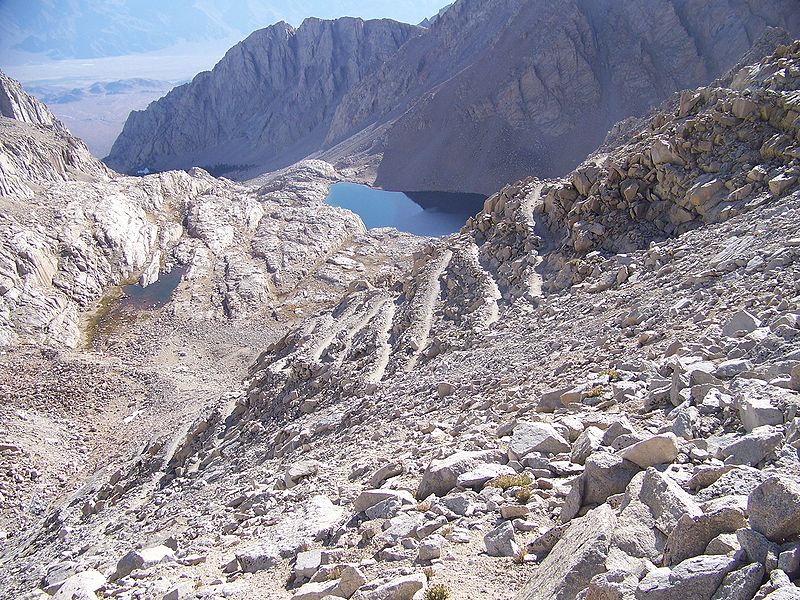
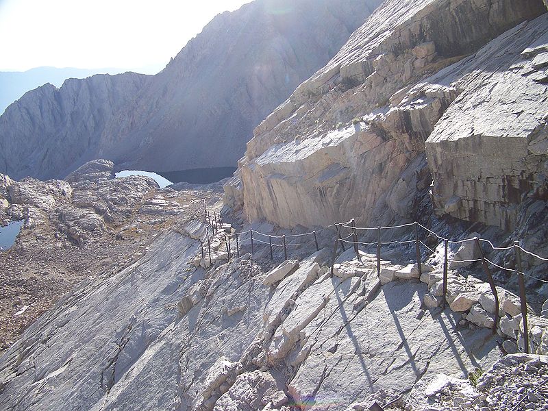
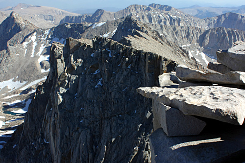
The Mount Whitney Trail is a trail that climbs Mount Whitney. It starts at Whitney Portal, 13 miles west of the town of Lone Pine, California. The hike is about 22 mi round trip, with an elevation gain of over 6,100 feet. It is a popular trail, and its access is restricted by quotas from May to October. ()
Mount Whitney United States
Mount Whitney plan & book
Unleash the traveler in you — discover the cheapest flight deals, find the perfect hotel or hostel nearby, and search for the best car rental prices. Travel at your own pace to discover new places and enjoy your journey.
Mount Whitney Trail – popular in the area (distance from the attraction)
Nearby attractions include: East Face, Mount Carillon, Mount Muir, Mount Hitchcock.
1.7 miNWHiking trail, Outdoor activities, ParkEast Face, Mount Whitney
44 min walk • The East Face of Mount Whitney is a technical alpine rock climbing route and is featured in Fifty Classic Climbs of North America. Mount Whitney is the highest peak in the contiguous United States.
2 miNMountainMount Carillon, Mount Whitney
51 min walk • Mount Carillon is a 13,553-foot-elevation mountain summit located on the crest of the Sierra Nevada mountain range in California.
1.4 miWNature, Natural attraction, MountainMount Muir, Mount Whitney
36 min walk • Mount Muir is a peak in the Sierra Nevada of California, 0.95 miles south of Mount Whitney. This 14,018-foot peak is named in honor of Scottish-born John Muir, a famous geologist, conservationist and founder of the Sierra Club.
2.6 miWMountainMount Hitchcock, Mount Whitney
68 min walk • Mount Hitchcock is a 13,186-foot-elevation mountain summit located west of the crest of the Sierra Nevada mountain range in Tulare County, California. It is situated in Sequoia National Park, and is two miles south-southwest of Mount Whitney, 1.3 mile southwest of Mount Muir, and 1.1 mile west of Trail Crest.
2.6 miNWMountainMount Randy Morgenson, Mount Whitney
67 min walk • Mount Randy Morgenson is a 13,927-foot-elevation mountain summit located along the crest of the Sierra Nevada mountain range in Tulare County, California. It is situated in Sequoia National Park, one mile north-northwest of Mount Whitney, 0.85 mile east of Mount Hale, and one-half mile west of Mount Russell, the nearest higher neighbor.
3.3 miSENature, Natural attraction, MountainMount Langley, Sequoia and Kings Canyon National Parks
83 min walk • Mount Langley is a mountain located on the crest of the Sierra Nevada, on the boundary between Inyo and Tulare counties in eastern California, in the United States. To the east is the Owens Valley, and to the west is the Kern River Valley. It is the ninth-highest peak in the state and the seventh-highest in the Sierra.
3 miSWMountainMount Pickering, Mount Whitney
77 min walk • Mount Pickering is a 13,474-foot-elevation mountain summit located just west of the crest of the Sierra Nevada mountain range in Tulare County, California. It is situated in Sequoia National Park, and is 3.1 miles south of Mount Whitney, 1.2 mile southeast of Mount Chamberlin, and one mile south of Mount Newcomb. Mt.
3.9 miSWMountainJoe Devel Peak, Mount Whitney
99 min walk • Joe Devel Peak is a 13,327-foot-elevation mountain summit located just west of the crest of the Sierra Nevada mountain range in Tulare County, California. Set in Sequoia National Park, it is situated 4.35 miles south of Mount Whitney, 1.5 miles southeast of Mount Chamberlin, and...
3.6 miWMountainMount Young, Mount Whitney
91 min walk • Mount Young is a 13,176-foot-elevation mountain summit located west of the crest of the Sierra Nevada mountain range in Tulare County, California. It is situated in Sequoia National Park, and is two miles west of Mount Whitney, one mile northwest of Guitar Lake, and one mile southwest of Mount Hale, the nearest higher neighbor.
2.3 miSWMountainMount Newcomb, Mount Whitney
60 min walk • Mount Newcomb is a 13,422-foot-elevation mountain summit located just west of the crest of the Sierra Nevada mountain range in Tulare County, California. It is situated in Sequoia National Park, and is 2.8 miles south of Mount Whitney, 1.1 mile northeast of Mount Chamberlin, and 3.5 miles west of Mount Corcoran. Mt.
2.2 miNWNature, Natural attraction, MountainMount Russell, Sequoia and Kings Canyon National Parks
56 min walk • Mount Russell is a peak in the Sierra Nevada mountain range in the U.S. state of California, about 0.8 miles north of Mount Whitney. With an elevation of 14,094 feet it is the seventh-highest peak in the state.