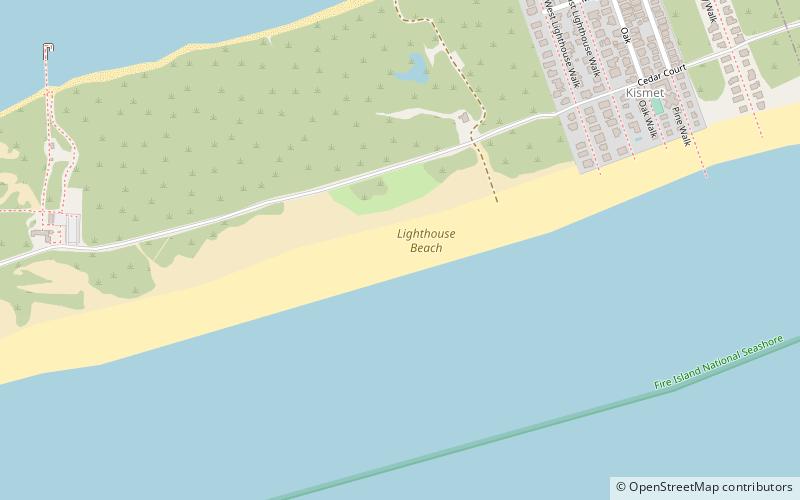
Lighthouse Beach, Fire Island
Map
Facts and practical information
Lighthouse Beach is a small section of the Fire Island National Seashore that is adjacent to Robert Moses State Park on New York's Long Island. It was notable for having sections that were officially designated as clothing optional prior to 2013. ()
Coordinates: 40°37'54"N, 73°12'31"W
Address
Fire IslandFire Island
ContactAdd
Social media
Add
Getting there by public transportation
Public transportation stops near this location
- Ferry
 Ferry
Ferry
- Calculate routeKismet Ferry Landing 12 min walk
- Calculate routeSaltaire Ferry Landing 22 min walk
Day trips


Frequently Asked Questions (FAQ)
Which popular attractions are close to Lighthouse Beach?
Nearby attractions include Fire Island Lighthouse, Fire Island (14 min walk), Lighthouse Beach, Fire Island (17 min walk), Saltaire, Fire Island (19 min walk).
How to get to Lighthouse Beach by public transport?
The nearest stations to Lighthouse Beach:
Ferry
Ferry
- Kismet Ferry Landing (12 min walk)
- Saltaire Ferry Landing (22 min walk)