Graham Mountain, Catskill Park
#25 among attractions in Catskill Park
Facts and practical information
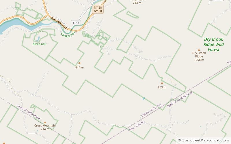
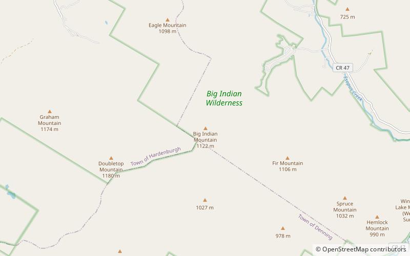
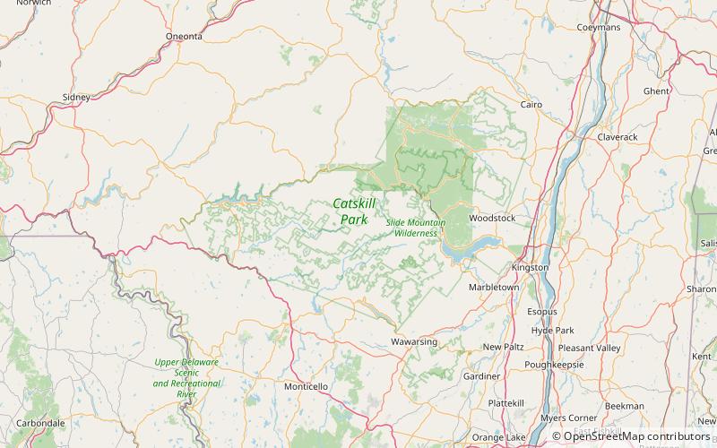
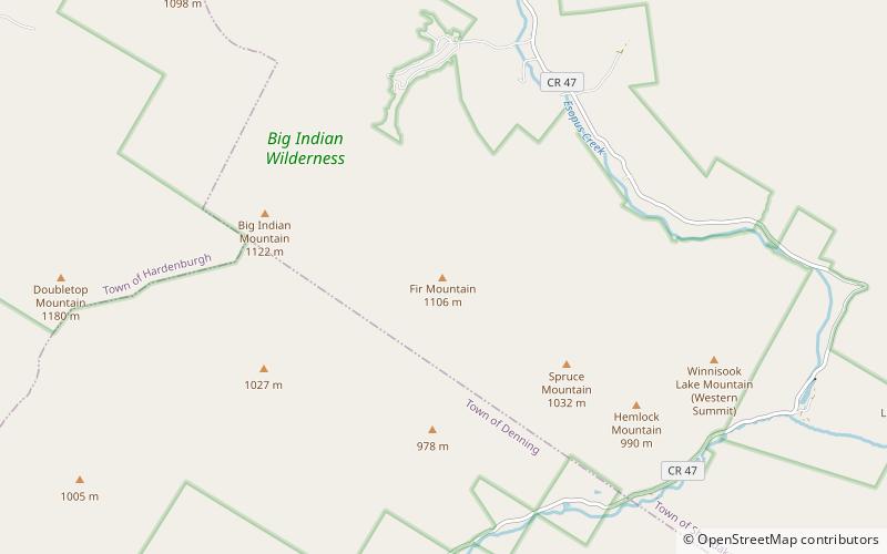
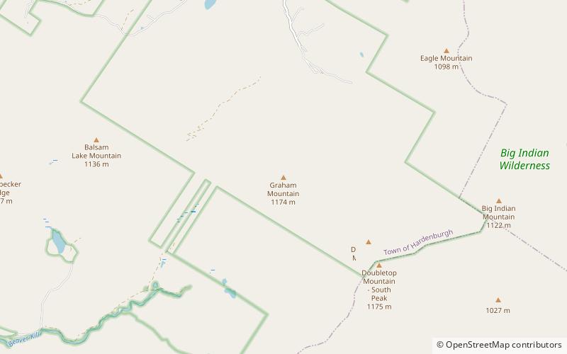
Graham Mountain is the seventh highest of the Catskill High Peaks and the highest privately owned mountain in the range. It is located in the town of Hardenburgh, New York, United States. ()
Catskill Park United States
Graham Mountain – popular in the area (distance from the attraction)
Nearby attractions include: Balsam Lake Mountain, Eagle Mountain, Dry Brook Ridge, Balsam Mountain.
4.1 miWNature, Natural attraction, MountainBalsam Lake Mountain, Catskill Park
105 min walk • Balsam Lake Mountain is one of the Catskill Mountains, located in the Town of Hardenburgh, New York, United States. It is the westernmost of the range's 35 High Peaks.
2.6 miNENature, Natural attraction, MountainEagle Mountain, Catskill Park
66 min walk • Eagle Mountain is a mountain located in Ulster County, New York. The mountain is part of the Catskill Mountains. Eagle Mountain is flanked to the north by Haynes Mountain, to the southwest by Doubletop Mountain and Graham Mountain, and to the southeast by Big Indian Mountain.
7 miNWMountainDry Brook Ridge, Catskill Park
178 min walk • Dry Brook Ridge is a ridge located in the Catskill Mountains of New York southeast of Margaretville. Pakatakan Mountain is located northwest of Dry Brook Ridge.
4.7 miNENature, Natural attraction, MountainBalsam Mountain, Catskill Park
121 min walk • Balsam Mountain is one of the High Peaks of the Catskill Mountains in the U.S. state of New York. Its exact height has not been determined, so the highest contour line, 3,600 feet, is usually given as its elevation.
5.9 miNEMountainBelle Ayr Mountain, Catskill Park
151 min walk • Belle Ayr Mountain is a mountain in the Catskill Mountains of New York southwest of Pine Hill. Fleischmann Mountain is to the west-northwest, Brush Ridge is north, Balsam Mountain and Haynes Mountain are south of Bell Ayr Mountain.
3.5 miNEMountainHaynes Mountain, Catskill Park
89 min walk • Haynes Mountain is a mountain located in the Catskill Mountains of New York south-southwest of Pine Hill. Haynes Mountain is located south of Belle Ayr Mountain, south-southeast of Hirams Knob, and north of Eagle Mountain.
4.1 miNMountainHirams Knob, Catskill Park
105 min walk • Hirams Knob is a mountain located in the Catskill Mountains of New York southeast of Mapledale. Balsam Lake Mountain is located southwest, and Haynes Mountain is located southeast of Hirams Knob.
4.9 miWTemple, Buddhist architectureDai Bosatsu Zendo Kongo-ji, Catskill Park
126 min walk • Dai Bosatsu Zendo Kongo-ji, or International Dai Bosatsu Zendo Kongo-ji, is a Rinzai monastery and retreat center located in the Catskill Mountains of upstate New York. Maintained by the Zen Studies Society, Dai Bosatsu Zendo Kongo-ji is led by Shinge-Shitsu Roko Sherry Chayat Roshi.
2.7 miENature, Natural attraction, MountainBig Indian Mountain, Catskill Park
69 min walk • Big Indian Mountain is a mountain located in Ulster County, New York. The mountain is part of the Catskill Mountains. It is flanked to the northwest by Eagle Mountain, to the southeast by Fir Mountain, and to the southwest by Doubletop Mountain.
1.3 miSENature, Natural attraction, MountainDoubletop Mountain, Catskill Park
34 min walk • Doubletop Mountain is a mountain located in Ulster County, New York. The mountain is part of the Catskill Mountains. Doubletop Mountain is flanked to the northwest by Graham Mountain, to the east by Big Indian Mountain, and to the southwest by the Beaver Kill Range.
4.2 miENature, Natural attraction, MountainFir Mountain, Catskill Park
107 min walk • Fir Mountain is a mountain located in Ulster County, New York. The mountain is part of the Catskill Mountains. Fir Mountain is flanked to the northwest by Big Indian Mountain, and to the southeast by Spruce Mountain.