Trek Zone

Dearborn Heights City Hall, Dearborn Heights

#2 among attractions in Dearborn Heights

City hall
Dearborn Heights City Hall

Facts and practical information

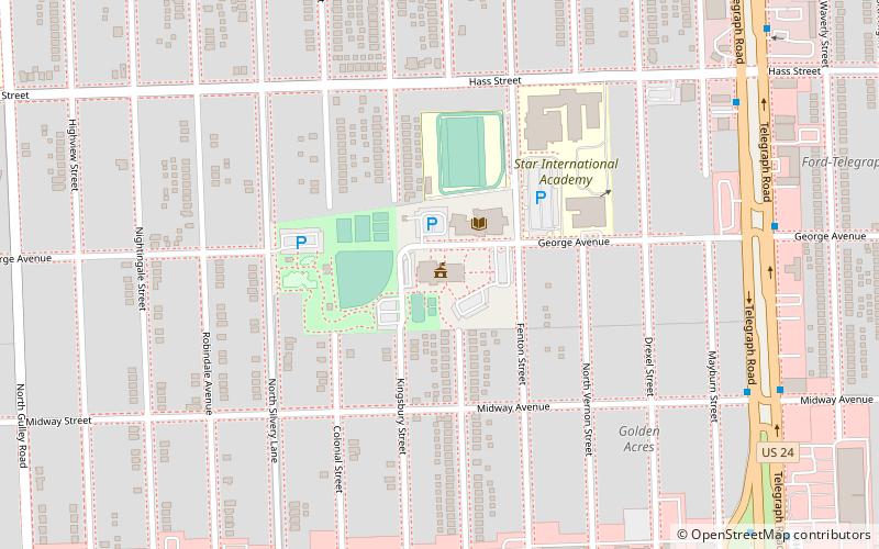
Dearborn Heights City Hall (address: 6045 Fenton St) is a place located in Dearborn Heights (Michigan state) and belongs to the category of city hall.

It is situated at an altitude of 617 feet, and its geographical coordinates are 42°19'53"N latitude and 83°16'45"W longitude.

Among other places and attractions worth visiting in the area are: St. Hedwig Cemetery (cemetery, 15 min walk), Dearborn Hills, Dearborn (outdoor activities, 51 min walk), Henry Ford College, Dearborn (universities and schools, 56 min walk).

Coordinates: 42°19'53"N, 83°16'45"W
Address

6045 Fenton StDearborn HeightsDearborn Heights United States

Contact
Social media
Add

Dearborn Heights plan & book

Unleash the traveler in you — discover the cheapest flight deals, find the perfect hotel or hostel nearby, and search for the best car rental prices. Travel at your own pace to discover new places and enjoy your journey.

Day trips

Dearborn Heights City Hall – popular in the area (distance from the attraction)

Nearby attractions include: The Henry Ford, Fairlane Town Center, Fair Lane, Automotive Hall of Fame.

  • the henry ford dearborn3 miSE
  • fairlane town center dearborn3 miE
  • fair lane dearborn2.7 miSE
  • automotive hall of fame dearborn location map
    2.9 miSE
  • dearborn hills2 miS
  • islamic center of america dearborn2.5 miE
  • dearborn historical museum2.5 miSE
  • tpc michigan dearborn location map
    4.3 miE
  • st sarkis church detroit2.6 miE
  • wonderland village livonia3.8 miNW
  • eliza howell park detroit location map
    4.3 miN

Where to next? Visit michigan Michigan region page or discover the top tourist attractions in United States.