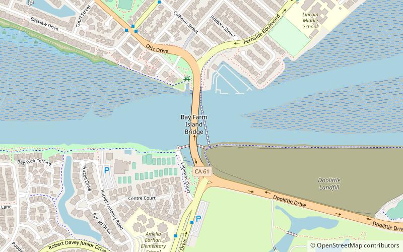
Bay Farm Island Bridge, Alameda

Gallery (1)
Map
Map
Facts and practical information
The San Leandro Bay Bridge, better known as the Bay Farm Island Bridge, is a single-leaf bascule drawbridge spanning the San Leandro Channel, the inlet of San Leandro Bay within the San Francisco Bay Area, California, United States. It carries California State Route 61 and links the main island of Alameda with Bay Farm Island within the city of Alameda. The present bridge was completed in 1953; it is paralleled by a second bridge devoted to pedestrian and bicycle traffic, the Bay Farm Island Bicycle Bridge. ()
Opened: 1 July 1953 (72 years ago)Length: 963 ftWidth: 70 ftCoordinates: 37°44'55"N, 122°14'10"W
Address
CA State Route 61Alameda
ContactAdd
Social media
Add
Getting there by public transportation
Public transportation stops near this location
- Bus
- Ferry
 Bus
Bus
- Calculate routeBay Farm Park and Ride 7 min walk
- Calculate routeRobert Davey Junior Drive & Packet Landing Road 10 min walk
- Calculate routeOtis Drive & Mound Street 11 min walk
- Calculate routeHarbor Bay Terminal 37 min walk
Day trips


Frequently Asked Questions (FAQ)
How to get to Bay Farm Island Bridge by public transport?
The nearest stations to Bay Farm Island Bridge:
Bus
Ferry
Bus
- Bay Farm Park and Ride • Lines: 21 (7 min walk)
- Robert Davey Junior Drive & Packet Landing Road • Lines: 21 (10 min walk)
Ferry
- Harbor Bay Terminal • Lines: San Francisco Bay Ferry (37 min walk)