Trek Zone

Laurel Avenue Church of Christ, Chesapeake
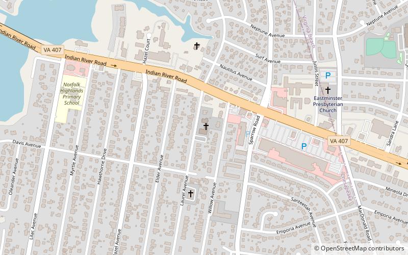
#14 among attractions in Chesapeake

Church
Laurel Avenue Church of Christ location map
Map

Facts and practical information

Coordinates: 36°49'13"N, 76°13'44"W
Address

1126 Laurel AveIndian River (Norfolk Highlands)Chesapeake 23325-3018 United States

Contact
+1 757-420-4937
Social media
Add
Day trips

Laurel Avenue Church of Christ – popular in the area (distance from the attraction)

Nearby attractions include: Harbor Park, Military Circle Mall, Bethany Baptist Church, Berkley Bridge.

  • harbor park norfolk3.2 miNW
  • military circle mall norfolk2.5 miNE
  • bethany baptist church chesapeake1.7 miSW
  • berkley bridge norfolk3.5 miNW
  • basilica of saint mary of the immaculate conception norfolk3.5 miNW
  • janaf shopping center norfolk location map
    2.9 miNE
  • st peters episcopal church norfolk2.9 miNW
  • norfolk portsmouth bridge tunnel3.4 miW
  • woodlawn memorial gardens norfolk location map
    3.2 miNE
  • south norfolk historic district chesapeake2.5 miW
  • oaklette chesapeake0.7 miNW

Where to next? Visit virginia Virginia region page or discover the top tourist attractions in United States.