Saint Croix National Scenic Riverway, St. Croix Falls

Gallery (1)
Map
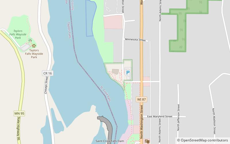
Map
Facts and practical information
Saint Croix National Scenic Riverway (address: 401 N Hamilton St) is a place located in St. Croix Falls (Minnesota state) and belongs to the category of body of water, park, museum.
It is situated at an altitude of 764 feet, and its geographical coordinates are 45°24'58"N latitude and 92°38'48"W longitude.
Among other places and attractions worth visiting in the area are: Cushing Land Agency Building (museum, 12 min walk), Taylors Falls Public Library, Taylors Falls (library, 23 min walk), Folsom House, Taylors Falls (history museum, 30 min walk).
Elevation: 764 ft a.s.l.Coordinates: 45°24'58"N, 92°38'48"W
Day trips


Frequently Asked Questions (FAQ)
Which popular attractions are close to Saint Croix National Scenic Riverway?
Nearby attractions include Cushing Land Agency Building, St. Croix Falls (12 min walk), Taylors Falls Public Library, Taylors Falls (23 min walk).