Islamic Society of Greater Dayton, Dayton
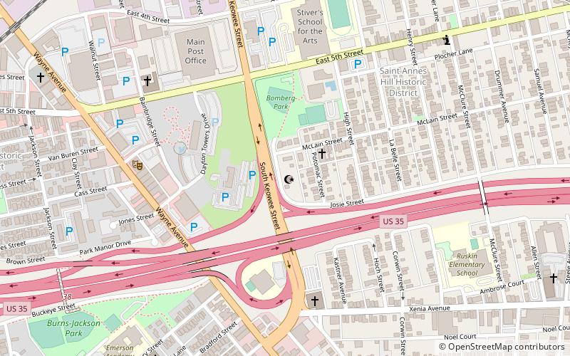
Map
Facts and practical information
The Islamic Society of Greater Dayton is a Sunni Muslim community organization based in Dayton, Ohio. The organization includes a mosque on Josie Street. Regular activities at the mosque include worship services, outreach, language classes, and religious classes. ()
Established: 1985 (41 years ago)Coordinates: 39°45'20"N, 84°10'34"W
Day trips


Frequently Asked Questions (FAQ)
Which popular attractions are close to Islamic Society of Greater Dayton?
Nearby attractions include Historic Inner East, Dayton (5 min walk), Saint Anne's Hill Historic District, Dayton (7 min walk), St. Mary's Catholic Church, Dayton (12 min walk), Oregon Historic District, Dayton (13 min walk).