Kountze Park, Omaha
Map
Facts and practical information
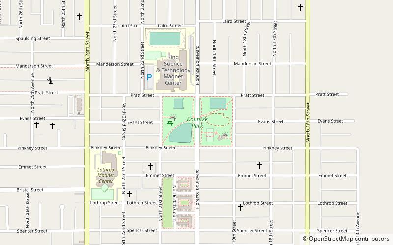
Kountze Park is an urban public park located at 1920 Pinkney Street in the Kountze Place neighborhood of North Omaha, Nebraska, in the United States. The Park is historically significant as the site of the Trans-Mississippi Exposition of 1898. ()
Created: 1889Elevation: 1030 ft a.s.l.Coordinates: 41°17'29"N, 95°56'32"W
Address
1920 Pinkney StEast Omaha (E. R. Danner)Omaha
ContactAdd
Social media
Add
Getting there by public transportation
Public transportation stops near this location
- Bus
 Bus
Bus
- Calculate routeNorth Omaha Transit Center 25 min walk
Day trips


Frequently Asked Questions (FAQ)
Which popular attractions are close to Kountze Park?
Nearby attractions include Kountze Place, Omaha (8 min walk), Calvin Memorial Presbyterian Church, Omaha (10 min walk), Sacred Heart Catholic Church, Omaha (10 min walk), Great Plains Black History Museum, Omaha (17 min walk).
How to get to Kountze Park by public transport?
The nearest stations to Kountze Park:
Bus
Bus
- North Omaha Transit Center (25 min walk)