Park West, Miami
Map
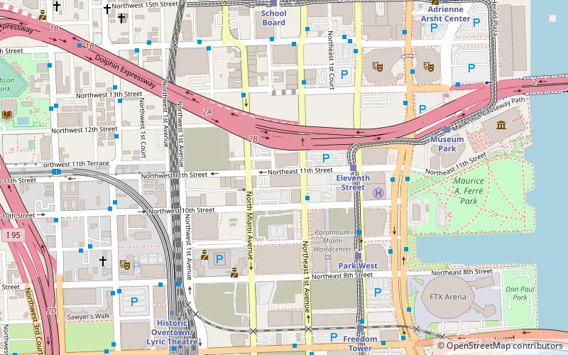
Map

Facts and practical information
Park West is a neighborhood of Greater Downtown, Miami, Florida, United States. It is roughly bound by Biscayne Boulevard to the east, West First Avenue to the west, North 7th Street to the south and Interstate 395 to the north. As of 2010, about 4,655 residents live in Park West. The neighborhood is named 'Park West' due to its location just west of Museum Park. ()
Coordinates: 25°47'5"N, 80°11'34"W
Day trips
Park West – popular in the area (distance from the attraction)
Nearby attractions include: Club Space, Pérez Art Museum Miami, Bayside Marketplace, Freedom Tower.
Frequently Asked Questions (FAQ)
Which popular attractions are close to Park West?
Nearby attractions include Omni Park, Miami (4 min walk), Ten Museum Park, Miami (5 min walk), One Thousand Museum, Miami (5 min walk), 900 Biscayne Bay, Miami (5 min walk).
How to get to Park West by public transport?
The nearest stations to Park West:
Bus
Train
Metro
Bus
- Northeast 1st Avenue & Northeast 10th Street • Lines: 9 (2 min walk)
Train
- Eleventh Street (4 min walk)
- Park West (6 min walk)
Metro
- Historic Overtown/Lyric Theatre • Lines: Green, Orange (9 min walk)
- Government Center • Lines: Green, Orange (16 min walk)


