Trek Zone

Hazel Landing Park, Carmel

#9 among attractions in Carmel

Bridge
Hazel Landing Park

Facts and practical information

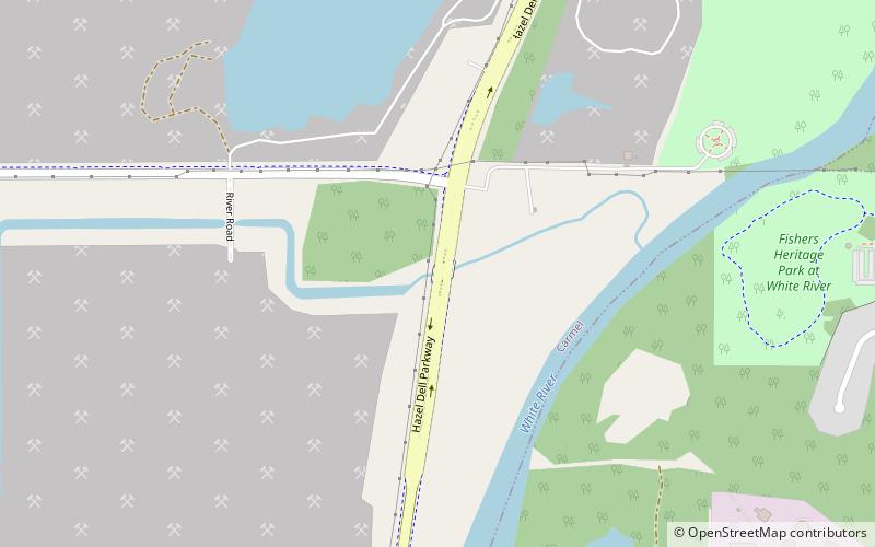
Hazel Landing Park (address: 10601 Hazel Dell Pkwy) is a place located in Carmel (Indiana state) and belongs to the category of bridge.

It is situated at an altitude of 735 feet, and its geographical coordinates are 39°56'24"N latitude and 86°4'30"W longitude.

Among other places and attractions worth visiting in the area are: Town Run Trail Park, Indianapolis (park, 44 min walk), Castleton Square, Indianapolis (shopping, 57 min walk), Marion County Bridge 0501F, Indianapolis (bridge, 64 min walk).

Coordinates: 39°56'24"N, 86°4'30"W
Address

10601 Hazel Dell PkwyCarmel United States

Contact
Social media
Add

Carmel plan & book

Unleash the traveler in you — discover the cheapest flight deals, find the perfect hotel or hostel nearby, and search for the best car rental prices. Travel at your own pace to discover new places and enjoy your journey.

Day trips

Hazel Landing Park – popular in the area (distance from the attraction)

Nearby attractions include: Clay Terrace, Castleton Square, Conner Prairie, The Fashion Mall at Keystone.

  • clay terrace carmel location map
    4.9 miNW
  • castleton square indianapolis2.2 miS
  • conner prairie fishers3.9 miNE
  • the fashion mall at keystone indianapolis location map
    2.6 miSW
  • hillcrest country club indianapolis4.6 miS
  • the palladium at the center for the performing arts carmel3.6 miNW
  • carmel clay public library3.6 miNW
  • museum of miniature houses carmel3.8 miNW
  • heady lane cemetery fishers2.8 miNE
  • prairie view golf club carmel3.1 miNE
  • second presbyterian church indianapolis5.4 miSW

Where to next? Visit indiana Indiana region page or discover the top tourist attractions in United States.