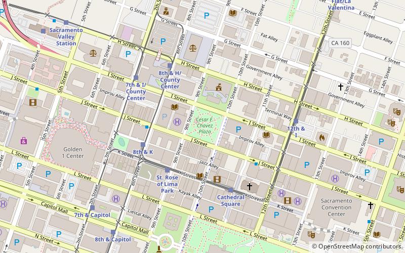
Cesar E. Chavez Plaza, Sacramento
Map
Facts and practical information
Cesar Chavez Plaza, or Cesar Chavez Park, is a city park in Sacramento, California, named after César Chávez. For more than a century the downtown square has been a focal point for community activities, including the Farmers' Market, music concerts, and community rallies. ()
Elevation: 26 ft a.s.l.Coordinates: 38°34'52"N, 121°29'38"W
Getting there by public transportation
Public transportation stops near this location
- Bus
- Light rail
- Train
 Bus
Bus
- Calculate routeSt. Rose of Lima Park 4 min walk
- Calculate route8th & K 4 min walk
- Calculate routeCathedral Square 5 min walk
- Calculate routeJ St & 8th St 4 min walk
- Calculate route7th & Capitol 8 min walk
- Calculate route8th & Capitol 9 min walk
- Calculate routeSt. Rose of Lima Park 4 min walk
- Calculate route8th & K 4 min walk
- Calculate routeCathedral Square 5 min walk
- Calculate route7th & Capitol 8 min walk
Day trips
Cesar E. Chavez Plaza – popular in the area (distance from the attraction)
Nearby attractions include: Downtown Commons, California State Capitol Museum, California State Capitol, Cathedral of the Blessed Sacrament.


Frequently Asked Questions (FAQ)
Which popular attractions are close to Cesar E. Chavez Plaza?
Nearby attractions include William Coleman Memorial Fountain, Sacramento (1 min walk), Sacramento City Library, Sacramento (2 min walk), Ruhstaller Building, Sacramento (2 min walk), Federal Building, Sacramento (3 min walk).
How to get to Cesar E. Chavez Plaza by public transport?
The nearest stations to Cesar E. Chavez Plaza:
Light rail
Bus
Train
Light rail
- St. Rose of Lima Park • Lines: Blue (4 min walk)
- 8th & K • Lines: Gold, Green (4 min walk)
Bus
- J St & 8th St • Lines: 70, 99, Md (4 min walk)
- 7th & Capitol (8 min walk)
Train
- St. Rose of Lima Park (4 min walk)
- 8th & K (4 min walk)