Four Peaks, Tonto National Forest

Gallery (4)
Map

Map
Gallery
Facts and practical information
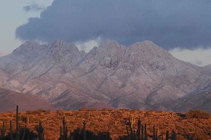
Four Peaks is a prominent landmark on the eastern skyline of Phoenix. Part of the Mazatzal Mountains, it is located in the Four Peaks Wilderness in the Tonto National Forest, 40 miles east-northeast of Phoenix. In winter, Four Peaks offers much of the Phoenix metro area a view of snow-covered peaks. Four Peaks is the site of an amethyst mine that produces top-grade amethyst. ()
Elevation: 7659 ftProminence: 3297 ftCoordinates: 33°41'3"N, 111°19'30"W
Address
Tonto National Forest
ContactAdd
Social media
Add
Day trips
Four Peaks – popular in the area (distance from the attraction)
Nearby attractions include: Mazatzal Mountains.
